Road 1116: Driving the Broken Asphalt from Szentendre to Visegrád
Road 1116 is a secondary mountain road located in Pest County, in Hungary. Cutting across the forest of the Duna-Ipoly National Park and the Pilis Mountains, the 19.4 km (12.0 miles) road crosses the mountain pass at Pap-rét at an elevation of 451 meters (1,479 ft) above sea level.
| Road facts: Road 1116 | |
|---|---|
| Location | Pest County, Pilis Mountains, Hungary |
| Elevation | 451 m (1,479 ft) at Pap-rét |
| Length | 19.4 km (12.0 miles) |
| Surface | Paved asphalt (severely deteriorated and pitted) |
How damaged is the asphalt surface on Road 1116?
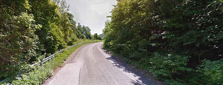
The entire 19.4 km route connecting Szentendre and Visegrád consists of heavily degraded tarmac. Decades of severe winter frosts combined with a complete lack of resurfacing have broken the roadbed, creating deep potholes, long longitudinal cracks, and uneven layers of old asphalt patches. Hitting these sharp, sunken holes at speed risks blowing out low-profile tires or bending front wheel rims on the steep mountain climbs.
Why are the forest bends toward Visegrád slick and hazardous?
The route runs under a heavy tree canopy that blocks out direct sunlight during the entire year. This permanent shade prevents moisture from evaporating, leaving the asphalt constantly slick with damp moss, fine wet mud layers, and decomposing autumn leaves. During the autumn freeze and spring thaws, these tight bends turn into slick tracks where tires lose lateral traction easily. The road lacks steel guardrails or concrete barriers on almost every curve, leaving car tires inches away from steep dirt banks and thick tree trunks lining the tarmac lip.
Is Road 1116 wide enough for oncoming trucks and delivery vans?
The paved road is pretty narrow in parts and completely lacks gravel or tarmac shoulders. The route carries regular local traffic from delivery vans, heavy timber logging trucks, and tourists driving toward the Visegrád Castle.
Road suggested by: Bela Zsalakovics