What are the most spectacular roads in Estonia?
Located in the northern part of Europe, Estonia is a mostly flat country, with no big mountains. The highest point in the country is Suur Munamagi, at 318m (1,043ft) above sea level, in Võru County. It’s the highest road of the country too.
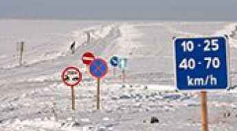
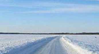
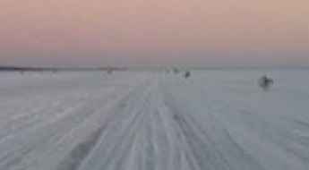
With cold winters influenced by its proximity to the Baltic Sea, when winter sets its icy fingers across the land, certain routes transform into ice roads. You can’t miss driving the longest ice road in Europe from Rohuküla to Heltermaa on the Baltic Sea, or driving the scenic Kihnu Ice Road. And located on the northwestern part of the country, the ice road from Tarkma to Triigi is a very exciting experience.
Driving the longest ice road in Europe from Rohuküla to Heltermaa on the Baltic Sea
Located in Estonia, the ice road running from Rohuküla (on the mainland) to Heltermaa (on the island of Hiiumaa) is said to be the longest ice road in Europe.
Suur Munamagi is the highest road of Estonia
Suur Munamägi ("Big Egg Mountain") is a mountain peak at an elevation of 318m (1,043ft) above sea level, located in Võru County in Estonia.
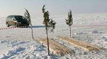
Driving the scenic Kihnu Ice Road in Estonia
Kihnu Ice Road is a challenging drive across the Baltic Sea, located in Estonia.
An Estonian ice road from Haapsalu to Purksi
Running across the Väinameri Sea in the Baltic Sea of Estonia, the ice road from Haapsalu to Pürksi is a challenging experience.
Driving the scenic ice road from Sviby to Rohuküla in western Estonia
Running from Sviby to Rohuküla (between the mainland and Vormsi) in the western part of Estonia, there's an ice road open during the winter months.
An ice road from Virtsu to Kuivastu on the Baltic Sea
Located in Lääne County of Estonia, the ice road across the Baltic Sea from Virtsu to Kuivastu is a unique experience for many drivers.
How to get by car to the scenic Elda Pank on Saaremaa Island?
Elda Pank is a coastal cliff located in Saaremaa Parish, at the northwestern tip of the Atla peninsula, in Estonia.
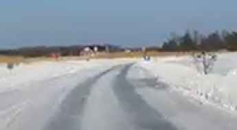
Driving Estonia’s Ice Roads
Situated on the northeastern part of Europe, Estonia is a low, flat country located on the eastern shores of the Baltic Sea. It is the northernmost of the three Baltic states.

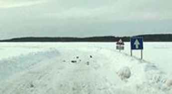
Driving the ice road from Tarkma to Triigi
Located on the northwestern part of Estonia, the ice road from Tarkma to Triigi is a very exciting experience.