Driving the scenic Adriatic Highway along the sea
Adriatic Highway is the name of a scenic drive running along the eastern coast of the Adriatic Sea through Croatia, Bosnia and Herzegovina, and Montenegro. It's one of the best coastal drives in the world.
How long is the Adriatic Highway?
Part of the European route 65 (E65), the road is totally paved. It’s around 1,000km (620 miles) long, running north-south from Rijeka, a Croatian port city on Kvarner Bay in the northern Adriatic Sea, through Bosnia and Herzegovina and ending at the Montenegro-Albania border. It is a two-lane road for almost its entire length, with the exception of a short dual-carriageway expressway between Sveti Juraj near Kaštela and Split.
How is the Adriatic Highway called?
Most of the highway is located in Croatia. In this country, the road is called D8 state road, with smaller parts in Istria made up of roads D66 and D75. In Bosnia and Herzegovina territory, the road is called M-2 road. And finally, in Montenegro, the road is officially known as M-1 highway.
How long does it take to drive the Adriatic Highway?
Plan about 12 hours to complete the drive without any stop. However, due to its beauty and winding its way along the coastline, plan a couple of days. It’s better to split the drive into shorter segments and make a holiday out of it.
Is the Adriatic Highway worth it?
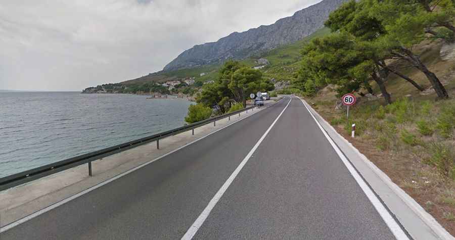
For many travelers, the Mediterranean seaside drive is the absolute dream road giving access to the Adriatic Sea beauties and its stunning beaches. The road has clear blue water to one side, and the view of islands in the distance. Offering beautiful landscapes and a breathtaking coastal panorama, it has to be seen to be believed. This highway is often taken by tour buses and individual tourists; major travel destinations can be found along its route, and the view of the ocean and countryside during the journey shows how the landscape changes from north to south.
When was the Adriatic Highway built?
Leading from Croatia down to Montenegro, the road was planned in the 1930s and built in the 50s and 60s at the time of Yugoslavian President Tito. It was open for traffic on 30 May 1965.
Is the Adriatic Highway safe to drive?
The road features collections of serpentine twists and turns, leading to a hole in the crash barrier, the sea hundreds of feet below. It swoops down close to the shoreline before climbing high over clifftops, often with nothing but a sheer drop on one side to the sea below. Experienced drivers may find the two-lane, curving highway, which is often positioned at the very edge of cliff ledges, thrilling, but those who prefer to give someone else control of the wheel should consider taking a bus tour with an experienced guide and professional driver. The highway is perfectly safe, usually not experiencing heavy traffic, even in summer, in the peak of the tourist season. Fuel is readily available all along the route and should pose no problems.