The road to Rila Lakes Hut: A steep climb to Bulgaria’s sacred lakes
Rila Lakes Hut (locally known as Hizha Rilski Ezera) is a high mountain refuge at an elevation of 2,107m (6,912ft) above sea level, located in the Kyustendil Province of Bulgaria.
Where is Rila Lakes Hut?
The hut is located in the southwestern part of the country, within the Rila National Park. It’s the main gateway to the world-famous Seven Rila Lakes.
Where does the road to Rila Lakes Hut start?
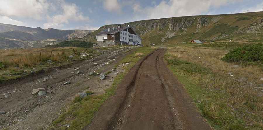
The track begins at a sharp bend on the paved Road 6206, just above the mountain resort of Panichishte. From this point, the asphalt ends and a rugged mountain track takes over, snaking up the northern slopes of the Rila Mountains toward the high-altitude plateau.
🇧🇬 Rila Lakes Hut Access Data
| Elevation | 2,107m (6,912ft) |
| Avg. Gradient | 11.85% |
| Distance | 2.7 km (Service Track) |
| Starting Point | Paved Road 6206 |
Is the road to Rila Lakes Hut unpaved?
The road is entirely unpaved and is primarily used as a service access for the chairlift and the refuge.
- The Route: The most intense section of the climb is 2.7 km (1.67 miles) long.
- The Challenge: In this short distance, the road gains 320 meters of elevation, resulting in a staggering average gradient of 11.85%. The surface is a mix of loose gravel, large rocks, and deep ruts carved by mountain runoff.
- Driving Conditions: The track is very narrow in sections, requiring a high-clearance 4x4 vehicle. It is notoriously bumpy and can become impassable during the frequent thunderstorms that hit the Rila range.
Access and Regulations
Because the road is located within the Seven Lakes Natural Reserve, private motorized access is strictly regulated.
- Impassable Season: The route is typically buried under meters of snow from October to June.
- The "Jeep Safari" Controversy: While officially a service road, local 4x4 operators often transport tourists up the mountain. However, travelers should be aware that the area is ecologically sensitive and low visibility due to heavy mist is common, making the steep drops along the track particularly dangerous.