How to get by car to Trebevic Mountain?
Trebević Mountain is a high mountain peak at an elevation of 1,232 m (4,041 ft) above sea level, located in the territories of Republika Srpska, Sarajevo, and East Sarajevo city, in Bosnia and Herzegovina.
Where is Trebević Mountain?
The peak, formerly known as Zlatni Do, is located south of Sarajevo, in the central part of Bosnia and Herzegovina. The views of Sarajevo and surrounding areas are amazing.
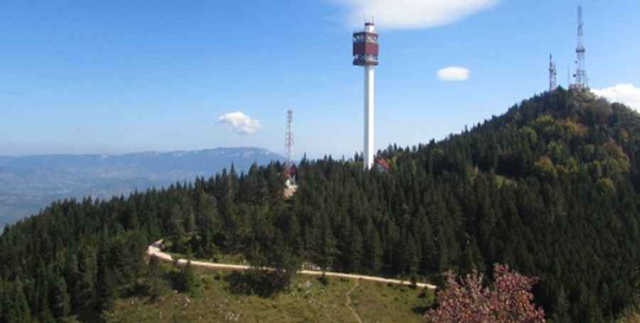
What’s at the summit of Trebević Mountain?
At the summit, there are communication facilities as well as a parking lot. It’s one of Sarajevo’s most popular outing spots as it was used for events in the 1984 Winter Olympics. It was also a vantage point for snipers and mortar positions during the siege of the Bosnian capital from 1992 to 1996.
How long is the road to Trebević Mountain?
The road to the summit features unpaved and paved parts. Starting from the paved R446a Road, the road to the summit is 2.25 km (1.4 miles) long.
Pic: Debeli Atletičar