How to drive the unpaved road from Corovode to Piskove?
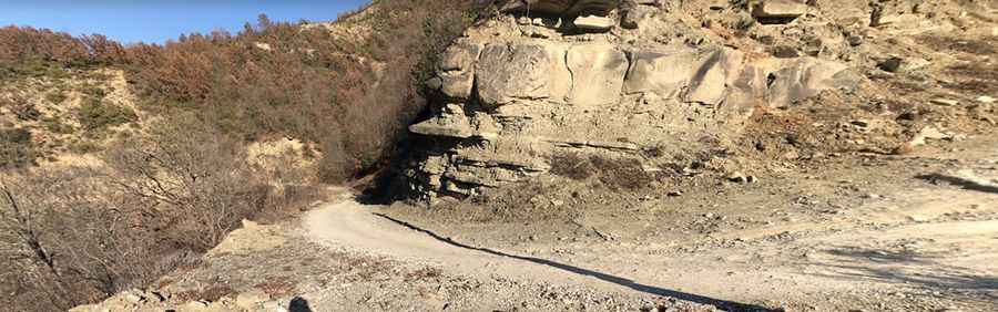
The Çorovodë-Piskovë Road is a rough gravel track running through the mountains of Albania. It’s said to be one of the most dangerous roads in the country.
How long is the road from Corovode to Piskove?
The road is 40km (24.85 miles) long. It links the villages of Çorovodë, also written as Çorovoda (in Berat County) and Piskovë (in Gjirokastër County). Expect more than 3 hours to cover this distance.
Is the road from Corovode to Piskove unpaved?
Located in the southern part of the country, the rough road is entirely unpaved. A 4x4 vehicle is necessary to complete the drive.
How challenging is the road from Corovode to Piskove?
The road is narrow and extraordinarily exposed. Drive with care as this is a mountain road with hairpin curves and dangerous dropoffs. It crosses steep gravelly slopes and what appear to be sheer rock faces, with narrow bends and stretches where you hope nobody will be coming your way. There are a few spots that can turn muddy in or after rain, and the trail should only be done in dry conditions.
Is the road from Corovode to Piskove worth the drive?
Set high in the Fir of Hotova National Park, the road has very steep parts. It tops out at 956m (3,136ft) above sea level. Along the way the Osum river created several natural canyons. It is rewarding to stop several times and enjoy a dip.
Pic: Rodney Wehr