SH74 in Albania: this road is not for timid drivers
Running through the mountains of Central Albania, the breathtaking SH74 road is not a piece of cake. Unless you have a 4×4, avoid it.
How long is SH74 in Albania?
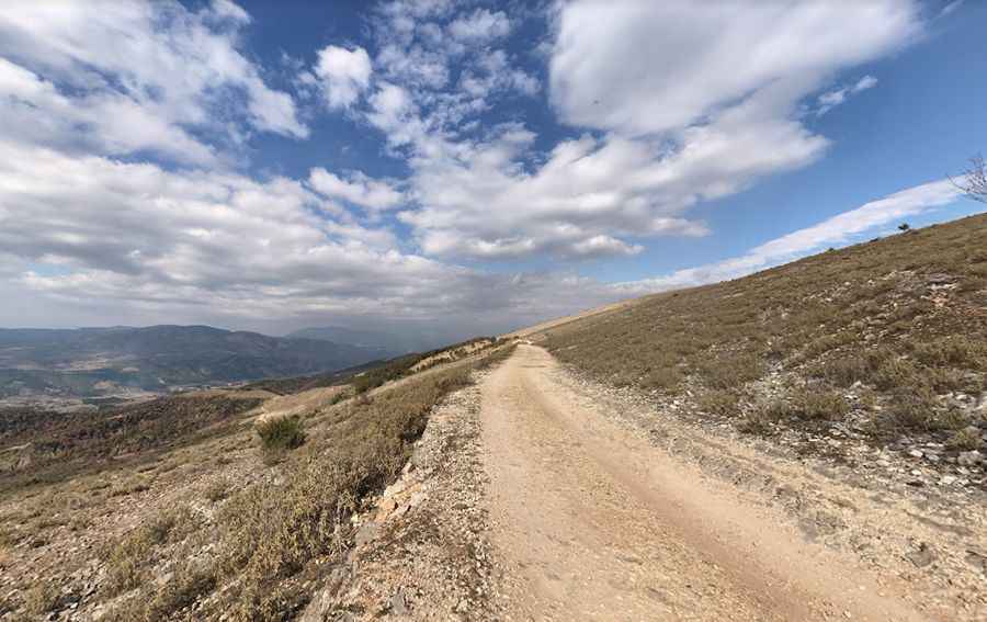
SH-74 (State Highway 74) is a single-lane unpaved track, totally unpaved with rocks everywhere. It’s 76.5 km (47.53 miles) long, running south-north from the SH75 road on Këlcyrë (in Gjirokastër county) to Berat (in Berat county).
Is SH74 in Albania challenging?
The road is extremely challenging. Nicknamed the Albanian Death Road, this treacherous piece of road clinging to the mountainside has it all: crumbling precipice edges, impossibly deep holes and ditches, throwing in rocks and mud and landslides. No local people use this road. Ideal time to travel is daylight. Not advised night drive. Google Maps misleadingly indicates that this road is a major route: unless you have a good 4×4, avoid it!
How long does it take to drive the SH74 in Albania?
To drive the road without stopping will take most people between 3.5 and 4.5 hours. The rough dirt track is not wide enough for two vehicles to pass. It tops out at 948m (3,110ft) above sea level. A good 4×4 vehicle with a reasonable level of ground clearance is required.
Pic: Rodney Wehr