How to get to Baru Volcano by car?
Volcán Barú is a dormant volcano at an elevation of 3.474m (11,398ft) above sea level, located in the Chiriquí Province of Panama. It is one of the few places in the world where, on a clear day, you can see both the Pacific Ocean and the Caribbean Sea from the summit.
Is the road to Baru Volcano unpaved?
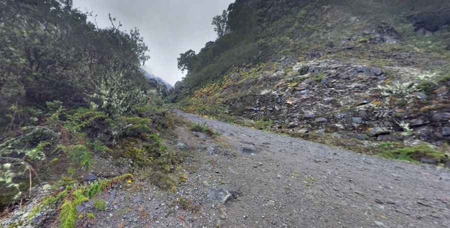
Set high in the western part of Panama, the road to the volcano (also called the Volcán de Chiriquí) is mostly unpaved. It’s called Volcancito Road or Camino Volcán Barú. A 4x4 vehicle is required to complete the drive.
How long is the road to Baru Volcano?
The road to the summit is 58.8km (36.53 miles) long starting from David, the capital of the Province of Chiriquí. It’s a really challenging road and a true test of your vehicle and your stamina because the road abounds in twists and turns with wheels sometimes hanging above the precipice. The start of the route is paved, but then turns into a rough 4-wheel drive dirt road almost all the way to the top.
Is the road to Baru Volcano worth the drive?
The summit is crowned with dozens of antennas. Due to its height and Panama's relatively short width, it is possible to see both the Pacific Ocean and Caribbean Sea from Volcán Barú's peak on a clear day. Occasional hail or ice pellet falls have been reported been reported on the summit, where the minimal temperature can be below 0°C (32°F) and the formation of frost is frequent during the dry season. The last known eruption is believed to have occurred around 1550 AD, though there are some historical records suggesting activity as recent as the 17th century.
Pic: edwin duarte