Driving the Wild Tebrakunna Road of Tasmania
Tebrakunna Road is a mostly unsealed route running through mountainous country located in the North-East LGA region of Tasmania.
Why is Tebrakunna Road Famous?
Hidden in the northeastern region of the country, this road serves primarily as a route for log trucks, offering an alternative to the Tasman Highway between Goshen and Herrick. While it doesn’t feature major tourist attractions, it does grant access to an extensive stretch of state forest and remains largely overlooked by travelers.
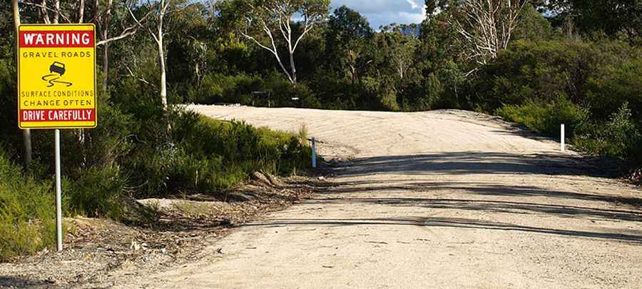
Is Tebrakunna Road unpaved?
The road comprises both paved and unpaved sections. Remember, surface conditions change often, so drive carefully. It has steep parts and tops out at 227m (744ft) above sea level.
How Long is Tebrakunna Road?
The road (part of the C841) is about 31 km (19 miles) long, running west-east from the paved B82 Road, near Pioneer, to the unpaved Ansons Bay Road (C843).
Is Tebrakunna Road open?
The road was closed for nearly three years after the Tebrakunna Bridge, a large timber beam structure over the Ringarooma River at Pioneer, was washed away during floods in the winter of 2007. A replacement concrete bridge, funded by the Federal Government, was completed and reopened to traffic on 31 March 2010.
Pic: https://www.ozroads.com.au/TAS/routenumbering/current/C841/06.jpg