What are the most spectacular roads in Tasmania?
Tucked away in the Southern Hemisphere, Tasmania is an island state of Oceania. It covers an area of 68,401 square kilometers, slightly larger than Sri Lanka or West Virginia. The country hosts some of the most spectacular drives in the world, and becomes a true paradise for drivers. You can’t skip driving Jacob's Ladder, a mountain road climbing up to Ben Lomond Mountain, at 1,452m (4,763ft) above sea level. It is one of the most hairpinned roads in the world.
With a landscape characterized by mountains, forests, and coastlines, Tasmania hosts the road to Mount Barrow, a mountain peak at 1,359m (4,458ft) above sea level. If you don’t like heights or twisty dirt roads, this drive is not for you. It's one of the most scenic drives in the world. Tasmania experiences a temperate maritime climate, with cool summers and mild winters, and attracts visitors from around the world. Another must-do is driving the wild paved road to the summit of Mount Wellington. It’s said to be the highest and busiest sealed alpine road in the country.
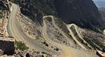
Jacob's Ladder is a zig-zag mountain road in Tasmania
Ben Lomond Mountain is a peak with an elevation of 1,452m (4,763ft) above sea level, located in the Launceston and North-east regions of Tasmania. The road to the summit, known for a series of sharp hairpin turns called Jacob’s Ladder, is one of the most hairpinned roads in the world.
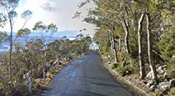
A wild paved road to the summit of Mount Wellington in Tasmania
Mount Wellington is a high mountain peak at an elevation of 1,265m (4,150ft) above sea level, located in the southeast coastal region of Tasmania. It’s said to be the highest and busiest sealed alpine road in the country.
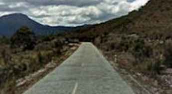
Highland Lakes Road is a true adventure in Tasmania
Highland Lakes Road is a pleasant driving experience in the Central Highlands of Tasmania. The road has steep climbs, hairpin bends, and lush forest, as well as panoramic views.
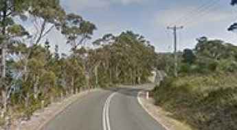
The road to Mount Barrow is worth the white-knuckle drive
Mount Barrow is a high mountain peak at an elevation of 1,359m (4,458ft) above sea level, located in Tasmania. If you don’t like heights or twisty dirt roads, this drive is not for you. It's one of the most scenic drives in the world.
Driving the Paved Gordon River Road Through Tasmania's Wilderness
Located in South West Tasmania, Gordon River Road is a scenic drive leading to the Gordon River Dam.
Driving the Challenging 4WD Sandy Cape Track in Tasmania
Located in the northern part of Tasmania's West Coast, in Australia, the Sandy Cape Track is one of Tasmania's most iconic 4WD destinations, featuring water hazards, rocky ridges, boggy sand, and mud sections.
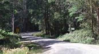
Driving the Wild Tebrakunna Road of Tasmania
Tebrakunna Road is a mostly unsealed route running through mountainous country located in the North-East LGA region of Tasmania.
A Sensational Road to Dove Lake in the Highlands of Tasmania
Dove Lake is a glacially carved lake at an elevation of 945 m (3,100 ft) above sea level, located in the central highlands region of Tasmania.
Lake Mackenzie is one of the highest lakes you can drive to in Tasmania
Lake Mackenzie is a mountain lake at an elevation of 1.122m (3,681ft) above sea level, located in the Launceston region of Tasmania.
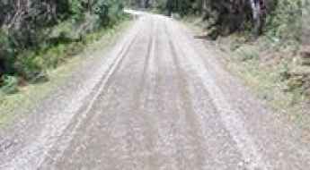
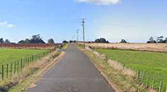
How to drive the challenging Camden Road?
Camden Road is a long, mostly unsealed north-south route located just east of Launceston, in northeast Tasmania.
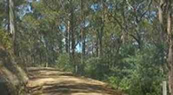
Road trip guide: Conquering the Wielangta Forest Drive
Wielangta Forest Drive is a very scenic drive located in Tasmania, running through tall eucalypt production forests.
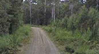
How To Travel The Swanston Track
Swanston Track is the name of a pretty challenging drive after rains, located in the Central LGA region of Tasmania.
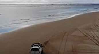
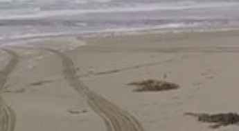
The Ultimate Guide to Traveling the Ocean Beach Road
Ocean Beach Road is the name of a very scenic drive located in the West Coast Council, on the most western point in Tasmania.
Clarks Road
Clarks Road is a very intimidating trail located in the south-east of Tasmania, Australia. Located within the Mount Dromedary Forest Reserve, this dead end road is 3.7 km long.
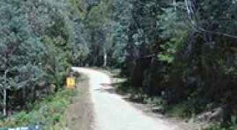
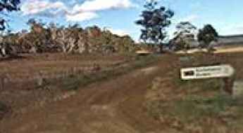
How To Travel The Borradaile Plains Track
Borradaile Plains Track is the name of an easy and scenic track (in dry weather) located in the local government areas of Meander Valley and Kentish in the North West region of Tasmania.
A beautiful and harrowing road to Eaglehawk Lookout
Eaglehawk Lookout is a small lookout at an elevation of 351m (1,151ft) above the sea level, located on the Tasman Peninsula in southeastern Tasmania. Be sure to have high clearance and four-wheel-drive.
Driving the scenic B68 in Tasmania
B68 is the name of a very scenic road located in the Australia's island state of Tasmania. The drive offers sweeping views.
The Haunting of Allison Road: The Murder of Chrissie Venn
Tucked in Tasmania’s North West region near Devonport, Allison Road winds through the quiet countryside of North Motton. Though it appears to be just another peaceful rural lane, it’s gained a sinister reputation over the decades. Locals and visitors alike have long whispered tales of strange happenings along this otherwise unremarkable stretch of pavement, claiming it to be one of the most haunted roads in Tasmania.
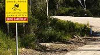
Biking Maria Island: The high-consequence gravel tracks of Tasmania
Located off the east coast of Tasmania, Maria Island is a rugged National Park where the internal combustion engine is banned. For the adventure seeker, this means the island's network of old industrial and farming tracks must be tackled by mountain bike or on foot. These are not manicured cycle paths; they are raw, exposed gravel service roads where the Southern Ocean winds and the steep topography of the Vardenis-like ridges create a high-consequence environment for the self-sufficient traveler.