Road trip guide: Conquering Lindis Pass in NZ
Lindis Pass is a mountain pass at an elevation of 966m (3,169ft) above sea level, located in New Zealand’s South Island. The pass crosses a saddle between the valleys of the Lindis and Ahuriri Rivers.
Where is Lindis Pass?
The pass is located on the boundary between the Canterbury and Otago regions in the southern part of the country. It links the Mackenzie Basin with Central Otago.
How long is Lindis Pass?
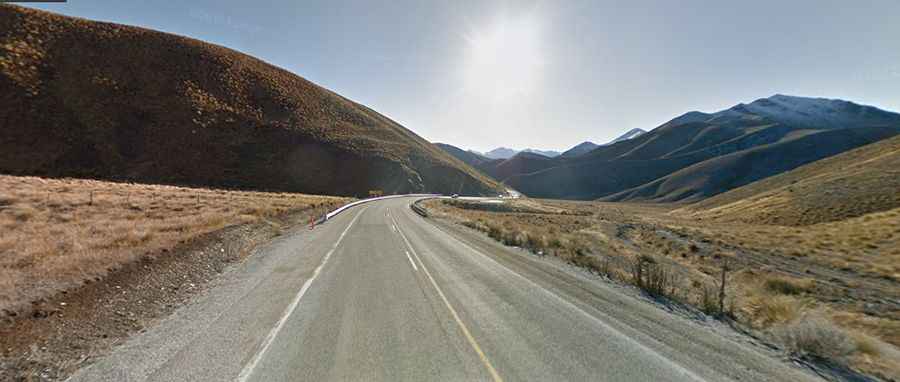
The road to the summit is fully paved and designated as State Highway 8. The pass spans 80.2 km (49 miles), running from Tarras in Central Otago to Omarama, near the southern end of the Mackenzie Basin. It marks the highest point on the South Island's state highway network.
Is Lindis Pass worth visiting?
The summit features a small parking lot and a lookout known as the Lindis Pass Summit Scenic Lookout. Adjacent to the highway is the Lindis Conservation Area, dominated by snow tussock grassland. Before reaching Lindis Pass when driving from Omarama, you can take a short detour down Ahuriri Valley and return via Birchwood Road, a gravel road.
Is Lindis Pass open?
The road is typically open year-round, although the weather in the area is unpredictable. Heavy snow and frequent ice are common in winter. Snowfall often reaches the roadside during many months of the year in this mountainous region.
Is Lindis Pass steep?
The road to the summit is quite curvy, requiring caution. It includes steep sections, with gradients reaching up to 10% in some areas. Due to its hilly nature, driving speeds of 100 km/h (62 mph) are not often attainable.