The road to Cape Palliser Lighthouse is one of NZ's best coastal drives
The Cape Palliser Lighthouse, located in the Wellington region on the southern coast of New Zealand's North Island, marks the end of one of the country's most scenic drives.
When Was the Cape Palliser Lighthouse Built?
The Cape Palliser Lighthouse, located at the southernmost point of the North Island, has been standing since 1897. After climbing approximately 250 steep steps, visitors reach the 18-meter-high lighthouse, which became automated in 1986. It flashes twice every 20 seconds, guiding vessels away from waters that were hazardous and claimed around 20 ships in the 19th century.
How Long Is the Road to Cape Palliser Lighthouse?
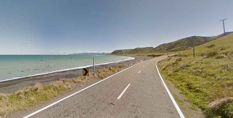
Cape Palliser Road spans 35 km (21 miles), beginning at Lake Ferry Road and offering stunning views. The road runs along steep cliffs on one side and the ocean with black-sand beaches on the other, providing breathtaking sea vistas.
Is the Road to Cape Palliser Lighthouse Paved?
Most of Cape Palliser Road is paved, but the last 7.2 km (4.47 miles) is gravel and can become muddy and slippery after rain. Caution is advised at erosion points like Whatarangi, and numerous one-lane bridges add to the road's unique character. If renting a car, verify your insurance coverage, as the section near the lighthouse is not fully sealed.
Is the Cape Palliser Lighthouse Worth It?
At the top, you'll find breathtaking views of Palliser Bay and the South Island. The nearby shoreline is home to the North Island’s largest fur seal colony, making it a must-see for wildlife enthusiasts. It’s one of the best coastal drives in the world.