Summit Road is a narrow scenic drive in New Zealand
Summit Road is a very scenic yet challenging drive located in Canterbury, on the east coast of New Zealand’s South Island.
When was Summit Road built?
The construction of the road started in the 1930’s (constructed by Harry G Eli), and opened to traffic on 26th February 1938.
How long is Summit Road near Christchurch?
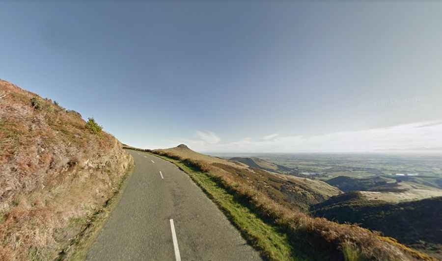
Set high in the Port Hills (Te Poho-o-Tamatea), the road is totally paved. It’s 28.2km (17,52 miles) long running from Sumner Road, south of Christchurch, to Gebbies Pass Road, near Motukarara. It’s the longest road owned by Christchurch City Council.
Is Summit Road open?
The road follows the rims of various extinct volcanoes that make up Banks Peninsula and tops out at 490m (1,607ft) above sea level. The road was closed after the earthquakes of 2010, 2011, under Section 46 of the Canterbury Earthquake Recovery Act due to the significant risk of further rockfall in aftershocks. Nearby tracks on park land were also closed. Sections of the road were indefinitely closed but some sections are open again.
Is Summit Road challenging?
Located to the south of Christchurch, be aware it is a bit narrow, twisty and a little scary when you meet a stock truck or wandering camper van. Windy, narrow and unguarded, the road climbs up several summits between 300 and 500 meters above sea level. The drive is very scenic, with panoramic views of Christchurch and its surrounds.