A steep single-lane dirt road to Mount Hutt in NZ
Mt Hutt Ski Area is a ski resort at an elevation of 1.597m (5,239ft) above sea level located in the Canterbury region of the South Island of New Zealand. The road to the resort can be pretty daunting.
How do you get to Mount Hutt?
The road to the summit is totally unpaved. It’s called Mount Hutt Skifield Road. A chairlift service road near the resort (-43.484616, 171.532040) climbs up to 2.062m (6,765ft) above sea level. It’s one of the highest roads in the country.
When was the road to Mount Hutt in NZ built?
Located to the west of the Canterbury Plains, it’s a steep, winding, dirt road built in the 1970s.
How long is the road to Mount Hutt in NZ?
Starting at the paved Mclennans Bush Road, the ascent is 14.1km (8.76 miles) long. Over this distance, the elevation gain is 1173 meters. The average gradient is 8.31%.
Is the road to Mount Hutt in NZ open?
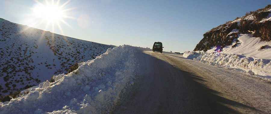
Set high within the Southern Alps, it can be ice-affected or muddy and slippery. It’s prone to closures in poor weather, so it is definitely necessary to carry chains. Mt Hutt receives 4 meters of snowfall on average per season. Poor weather results in the resort being fully closed 14 days per season on average.
Is the road to Mount Hutt in NZ challenging?
Many corners are sharp and without barriers. The road to the summit is brutally steep, hitting a 24% maximum gradient through some of the ramps. When the weather is good, a 2WD vehicle will easily make it to the top.
Pic:https://do.co.nz/portfolio/mount-hutt/