A legendary drive to Arthur's Pass in NZ
Arthur's Pass is a mountain pass at an elevation of 739m (2,425ft) above sea level, located in the South Island of New Zealand.
Where is Arthur's Pass?
The pass is located on the boundary between the West Coast and Canterbury regions, within the Arthurs Pass National Park, the major national park in the center of the South Island, New Zealand.
Who is Arthur's Pass named after?
The pass derives its name from Sir Arthur Dudley Dobson (1841–1934), who guided the initial group of Europeans through the pass in 1864.
Where was Arthur's Pass built?
The road through the pass was a traditional Maori trading route through the high Alps and was first established for wheeled traffic (horse-drawn coaches) in 1866, following the discovery of gold in Westland. The road was built by laborers with picks, shovels, wheelbarrows, and two-horse drays. It connected Hokitika and Christchurch. Many lives were lost during the road construction. Tragically, six people were drowned in one week, and other drownings are also recorded due to frequently flooded rivers.
Can you drive through Arthur's Pass?
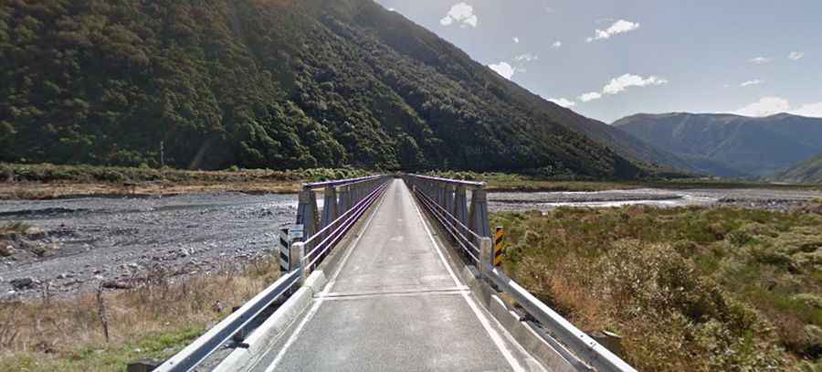
Driving Arthur's Pass road is one of the most stunning experiences in New Zealand. The road to the summit is the iconic Great Alpine Highway, officially known as State Highway 73 ('SH 73') and also known as West Coast Road. Arthur’s Pass, climbing to more than 900 meters through Arthur's Pass National Park, is the highest and most spectacular pass across the Southern Alps. It is a piece of extreme engineering involving viaducts, bridges, rock shelters, and waterfalls redirected into chutes. The pass is the highest point on the road. Be careful: thieves have been breaking into cars and motor-homes at various car parks along highway 73 on a regular basis.
Is Arthur's Pass challenging in winters?
The road is fully paved. It is majestic and beautiful but can be a test of nerves for the driver, particularly in winter when snow and ice may cover the road, and chains are recommended at times. Consider taking the train or coach to Arthur's Pass instead. An average annual rainfall of 4000 to 7000 millimeters per year is recorded, and snowfalls during winter are frequent, with minimum temperatures ranging between -1 and -2 degrees Celsius. Arthur’s Pass has been closed for extended periods before. Not just in winter either, rain can cause slips. So, have a plan in case this happens to you.
How steep is Arthur's Pass?
Over the years, work has been done to improve blind corners and ease bends. However, the nature of the landscape and the weather can still make the Otira Gorge and Arthur's Pass road a challenging driving experience. The road is very steep, with sections reaching up to a 16 percent gradient.
How long is Arthur's Pass?
The pass is 44.6 km (27.71 miles) long, running north-south from Jacksons, a settlement in the Westland District of the West Coast, to Bealey. There are 11 bridges with a total length of 406.6 meters.
How long does it take to drive Arthur's Pass?
Situated high in the Southern Alps of the South Island of New Zealand, allow 45 minutes for the drive from Jacksons to Bealey. The pass is a popular base for exploring Arthur's Pass National Park.