Travel guide to the top of Saddle Hill in NZ
Saddle Hill is a mountain pass at an elevation of 413m (1,354ft) above the sea level, located in the north end of the South Island of New Zealand.
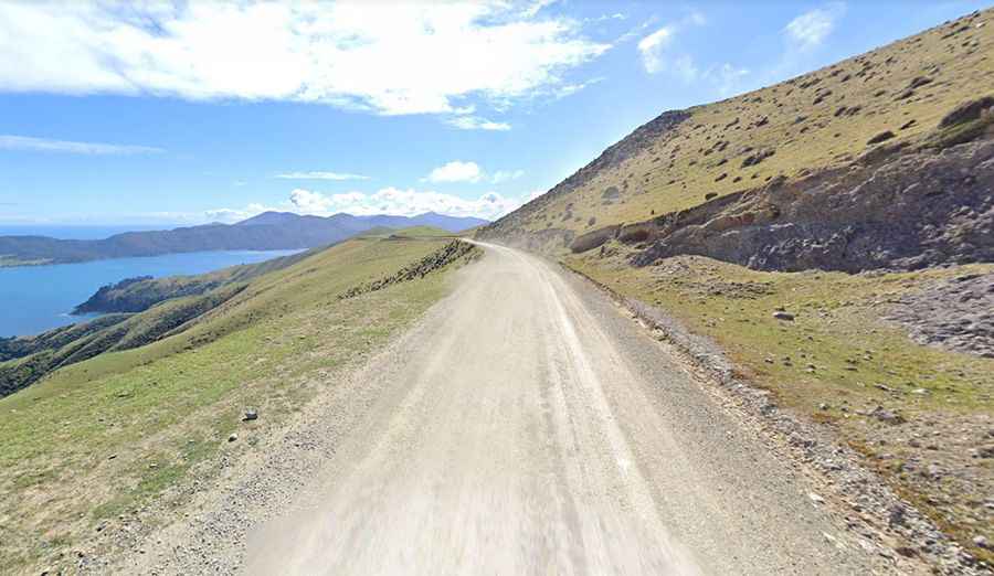
Tucked away in the Marlborough Sounds, the road to the summit is partially unsealed and is narrow and winding but navigable by all passenger vehicles. It’s called French Pass Road. It is well maintained and remains a true ‘kiwi’ road: gravel, with one-lane bridges, hairpin turns and narrow parts with sheer drops on one side. Sheep and cattle roam freely over the hillsides, and cattle stops (and gates) are frequent. You will quickly secure all drawers and loose items after passing over your first cattle stop.
The pass is 38.3 km (23.79 miles) long running south-north from Ōkiwi Bay to French Pass, a quiet fishing and tourist village. To drive the road without stopping will take most people between 1 and 2 hours. The road has no traffic: it’s possible to go the entire way to French Pass without seeing another car. It’s said to be one of the most scenic in New Zealand, featuring farmland, mineral belt, native bush and dramatic sea views of the French Pass and d’Urville Island. The pass is steep in parts, hitting a 9% of maximum gradient through some of the ramps.