A Most Tricky Scenic Drive to Remutaka Pass in NZ
Remutaka Pass is a mountain pass at an elevation of 556m (1,824ft) above sea level, located in New Zealand's North Island. The road is well known to NZ motorcyclists.
Where is Remutaka Pass?
The pass, also known as Remutaka Hill and Rimutaka Pass, is located north of Wellington, in the Wellington Region, in the southern part of the island.
What’s at the summit of Remutaka Pass?
The pass was formally named on 17 December 2015. It was changed to Remutaka to reflect the correct Māori spelling. At the summit, there is a parking lot and a lookout point (a very short and steep scramble up the little track from the car park) with awesome 360-degree views. The weather can be variable, so views aren’t a given, but the lookout is a convenient stopping place. It provides great views of the Hutt Valley on one side and down towards Featherston on the other.
Is the road to Remutaka Pass paved?
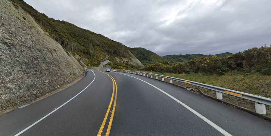
The road to the summit is totally paved. It’s called Rimutaka Hill Road, part of the State Highway 2 (SH2). The road is winding and steep, but it is well-maintained and offers stunning views along the way.
How long is the road to Remutaka Pass?
The pass road is 31.0 km (19.26 miles) long, running west-east from Upper Hutt to Featherston.
Is the road through Remutaka Pass challenging?
The road is very winding and treacherous. It hits a 21% maximum gradient through some of the ramps. The drive is well known to NZ motorcyclists. Traffic can be heavy at times, e.g. during holiday periods.
Is the road to Remutaka Pass open?
Set high in the Remutaka Range, conditions of the road can vary enormously. There are frequent road closures. The area is prone to slips, strong gales, and driving rain. In winter, the road can often be shrouded in mist, or may be closed for brief periods due to snow or landslips. Be prepared for strong wind gusts and exposed sections the higher you go.