What are the most spectacular roads in New Zealand?
Located in the southwestern Pacific Ocean, New Zealand is an island country that comprises two main landmasses: the North Island and the South Island, with around 700 smaller islands. Similar in size to Italy or Japan, it covers an area of 268,680 km2 (103,740 sq mi).
Due to its geography, with mountain ranges, fjords, volcanic plateaus, and coastal plains, it features some of the most spectacular roads in the world. When traveling to New Zealand, you can not miss driving Skippers Canyon Road. Tucked away in the southwest of the South Island, it is now one of New Zealand's better-known scenic roads and is unbelievably scary, being extremely narrow and difficult to maneuver.
For those who prefer scenic drives, the Forgotten World Highway is one of the world's top drives. It’s also worth driving the scenic Crown Range Road, an exhilarating road with hairpin bends, serpentines, and steep grades on the South Island. And if you prefer mountain roads, you can not skip the sensational road to the Remarkables in Queenstown, a ski resort at 1,622m (5,321ft) above sea level. And do not forget to check out our content about the highest roads in the country, where altitude and adventure pose a breathtaking challenge.
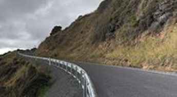
Nugget Point Lighthouse
Nugget Point Lighthouse is a lighthouse at Nugget Point in the Otago region of the South Island of New Zealand. The road is 8.9km long.
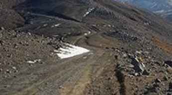
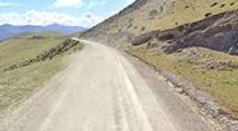
Ultimate 4wd destination: Tukino Skifield in NZ
Tukino Skifield is a ski resort at an elevation of 1.705m (5,593ft) above the sea level, located in the Waikato Region in the central area of the North Island, New Zealand. It’s one of the highest roads of the country.
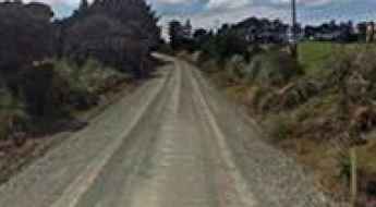
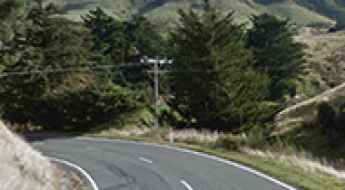
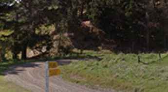
Henderson Bay Road
Henderson Bay Road is a short metal road connecting Henderson Bay to the State Highway 1. This very quiet little road is 6km long and is located north of Kaitaia, the northern most city in New Zealand.
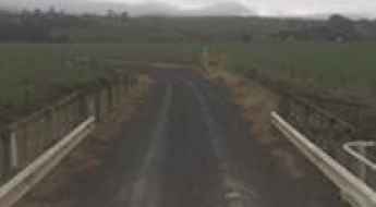
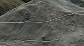
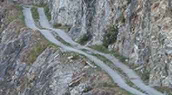
Driving the Taumatamaire Road is not a piece of cake
Taumatamaire Road is the name of a very challenging drive located in the western North Island of New Zealand.
Dobson Peak
Dobson Peak is a high mountain peak at an elevation of 2.019m (6,624ft) above the sea level, located in the South Island of New Zealand. It’s one of the highest roads of the country.
Take the Scenic Route and Discover Gebbies Pass in NZ
Gebbies Pass is a high mountain pass at an elevation of 161m (528ft) above the sea level, located in Canterbury, on the east coast of New Zealand’s South Island.
Travel guide to the top of Saddle Hill in NZ
Saddle Hill is a mountain pass at an elevation of 413m (1,354ft) above the sea level, located in the north end of the South Island of New Zealand.
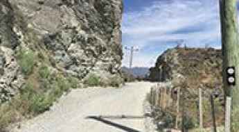
The Ultimate Guide to Traveling Chard Road in NZ
Chard Road is the name of a very demanding cliff drive located in the Otago region of New Zealand.
Everything you need to know about the tough Dingle Burn Peninsula Track in NZ
Located in the heart of New Zealand's South Island, the defiant Dingle Burn Peninsula Track is one of the toughest tracks of the country.
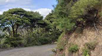
Mimiwhangata Road
Located south of Helena Bay on the east coast of Northland, New Zealand, the Mimiwhangata Road is a narrow and winding adventure. It still remains an adrenaline-pumping journey and is definitely not for the faint of lungs, heart, or legs.
Driving the scenic Great Alpine Highway of New Zealand
The Great Alpine Highway is an unforgettable adventure running from Christchurch to the West Coast of the South Island, New Zealand. This beautifully scenic road trip promises a breathtaking experience, taking you through charming historic towns and a captivating array of landscapes.
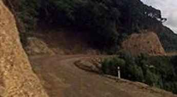
Driving the unpaved road to Jollies Pass in Hanmer Springs
Jollies Pass is a mountain pass at an elevation of 845m (2,772ft) above sea level, located in the Canterbury region of New Zealand’s South Island. The rough road to the summit has very steep conditions.
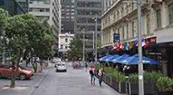
The Best Auckland Road Trips
Driving out of Auckland, New Zealand’s primary logistics hub, involves navigating a transition from high-capacity motorways to technical, winding coastal roads. Regional transit towards Northland or the Coromandel Peninsula requires specific attention to road surface changes, steep gradients, and the logistical challenges of remote fuel availability and rapid maritime weather shifts.
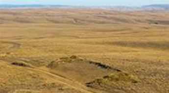
An epic enthralling road to Rough Ridge in NZ
Rough Ridge is a mountain pass at an elevation of 1.040m (3,412ft) above the sea level, located in the Otago Region in the South Island of New Zealand.
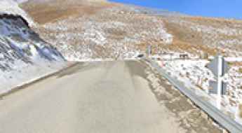
Taking on the Twists and Turns of Crown Range Summit in NZ
Crown Range Summit is a mountain pass at an elevation of 1,079m (3,540ft) above sea level, located in Otago in the southwest of New Zealand's South Island.
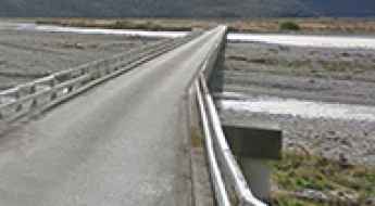
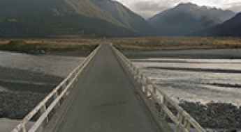
Bealey Bridge is a key crossing over Waimakariri River
Located in the Canterbury region of New Zealand's South Island, Bealey Bridge is a crucial structure along the Great Alpine Highway (State Highway 73). It’s one of the most spectacular bridges in the world.

11 Useful Hacks for Motorhome Rentals in NZ
Managing a motorhome rental in New Zealand (NZ) requires strict control over cargo distribution and the maintenance of onboard systems. The following 11 technical points are essential to ensure vehicle operability and safety during transit.
Top safety tips for driving in New Zealand
If you’re getting ready for an upcoming holiday in the wild and woolly land of New Zealand, you’ve got a lot to look forward to. A self-driving trip might just be the best possible way to enjoy this stunning country.
Driving the challenging coastal road to Stony Bay in NZ
Located in Northern Coromandel in the Coromandel region, the unsealed, narrow, and winding road leading to Stony Bay is very challenging. Be prepared for larger traffic numbers over the summer period.
Cape Campbell Lighthouse is a Beacon Amidst New Zealand's Scenic Landscape
Situated in the Marlborough region of New Zealand's South Island, the Cape Campbell Lighthouse stands as a testament to maritime history and engineering. Its striking black and white stripes are not only visually captivating but also serve a functional purpose for sailors navigating the nearby waters.
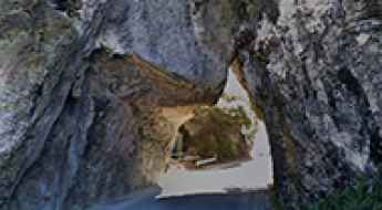
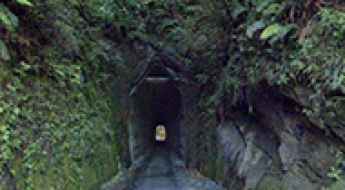
Driving through the Pohara Natural Bridge in the South Island
The Pohara Natural Bridge is located on the South Island of New Zealand, along the coast near the Tasman Sea. It lies between two islands and forms a natural passage through a rock formation. It’s one of the few roads in the world that runs through a cave.
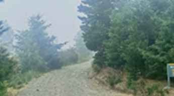
The Road to Broken River Ski Area is for the Adventurous Spirit Only
Broken River Ski Area is a ski resort at an elevation of 1,543m (5,062ft) above sea level, located on New Zealand's South Island. The ski field often claims to have the longest ski season in Australasia.
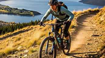
A Quick Guide to Choosing the Right Bike Track in Queenstown NZ for Your Skill Level
Queenstown, New Zealand, boast some of the world’s best bike tracks. There’s the history-rich Otago Central Rail Trail, the scenic Lake Hayes Hoop Trail, and the challenging Fernhill Loop. With the town’s ample variety of bike tracks, riders of all levels are welcome to get on their bikes and explore what the routes have to offer.