What are the Australia's longest roads? Top 13
Australia is a vast country, and traversing epic, lengthy roads is a common experience. Given the extensive distances between population centers, certain roads are exceptionally long, cutting through some of the most remote and beautiful landscapes on Earth. These highways are the lifelines of the continent, connecting isolated mining towns, massive cattle stations, and coastal hubs.
Safety and Endurance on the Road
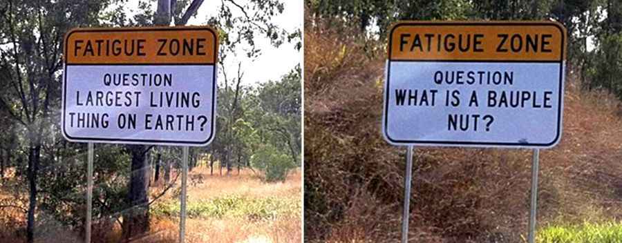
To enhance safety and reduce accidents caused by fatigue, authorities have installed trivia signs and "Fatigue Zones" along the loneliest stretches. These signs aim to keep drivers alert and engaged in environments where the scenery might not change for hundreds of kilometers, helping to reduce fatalities on long-haul trips.
From the Outback to the Coast
Whether winding through the stunning, red-dusted Outback or stretching across the coastal landscapes, these roads offer not just a journey but an exploration of the vastness that defines Australia. Below is a list of the longest roads that define the Australian driving experience:
| Road | States | Length | Highest Point | Lowest Point |
|---|---|---|---|---|
| Great Northern Highway | WA | 3.195km (1,985mi) | 748m | 0.54m |
| Stuart Highway | NT-SA | 2.834km (1,761mi) | 731m | 9.32m |
| Eyre Highway | SA-WA | 1.675km (1,041mi) | 435m | 2.28m |
| Bruce Highway | Q | 1.652km (1,027mi) | 192m | 1.57m |
| Diamantina Developmental Rd | Q | 1.344km (835mi) | 426m | 72.6m |
| Anne Beadell Highway | SA-WA | 1,340km (832mi) | 478m | 161m |
| North West Coastal Highway | WA | 1.299km (807mi) | 287m | 4.98m |
| Mitchell Highway | Q-NSW | 1.105km (687mi) | 1.020m | 103m |
| Burke Developmental Road | Q | 1.079km (670mi) | 645m | 1.8m |
| Landsborough Highway | Q | 1.049km (652mi) | 476m | 166m |
| Tanami Road | WA-NT | 1.013km (629mi) | 740m | 302m |
| Barrier Highway | NSW-SA | 1.014km (630mi) | 609m | 70.5m |
| Trans Access Road | WA-SA | 993km (617mi) | 407m | 95.6m |
Road length is an approximation only. Some roads are split into more than one part because they pass through a place where the road is differently named.