Driving Waterfall Way in NSW: constant attention is required
Waterfall Way (NSW State Route 78) is a very scenic drive located in Northern New South Wales, Australia. The road runs through rainforest, river valleys and waterfalls, including New England and Dorrigo National Parks.
Where does Waterfall Way start and finish?
Tucked away in the NSW Mid North Coast, the road is 169.8 km (106 mi) long running from the New England Highway at Armidale to the Pacific Highway near Urunga (20 minutes drive south of Coffs Harbour). Traffic volumes along the Waterfall Way vary in the rural sections from around 750 vehicles per day (VPD) between Dorrigo and Ebor to over 6,700 VPD between the Pacific Highway and Bellingen. In recent years storms and associated flash flooding have washed away sections of the roadway, leading to traffic being limited to one lane at the Newell and Sherrard Waterfalls on the Dorrigo Range.
How to drive the Waterfall Way in NSW?
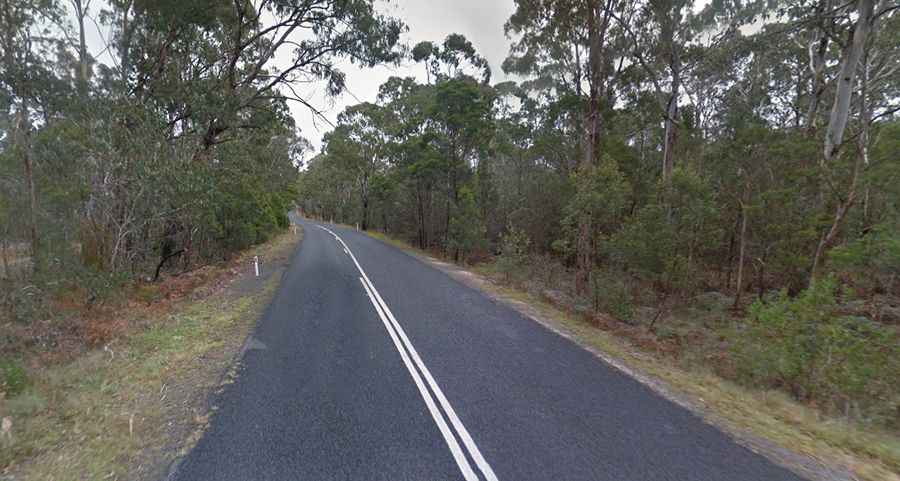
The road is fully sealed but relatively narrow and potentially treacherous, with steep and winding sections. It has a pretty steep 14 km winding section west of Thora. In many places the road is cut into solid rock of the mountain side, while its outer edge is built up of stonework, and the curves are so sharp that the utmost care is required by teamsters in negotiating them. In one of the gorges, hundreds of feet deep, may now be seen the whitened bones of what originally constituted one of the finest horse teams that travelled the district. Thousands of dollars have been spent on the road, and many of the dangerous portions have been fenced, but constant attention is required on account of the heavy rainfall and steep grades. Overtaking opportunities may be limited along the route, especially on the Dorrigo Range. Pay attention to the wildlife warning signs.
Is the Waterfall Way NSW a dangerous road?
There were 314 reported crashes along the corridor between January 2010 and December 2014 resulting in 180 casualty crashes involving either an injury or fatality. Of the casualty crashes there were nine fatal, 61 serious injury, 53 moderate injury, 32 minor injury and 25 uncatergorised injury crashes. This equates to a crash rate of 0.21 casualty crashes/per kilometre/per year which is higher than 0.077 casualty crashes/ per kilometre/per year on other comparable roads of this standard across the State. Many of the crashes go unreported if the driver and passengers are uninjured.
How long does it take to drive Waterfall Way?
To drive the road without stopping will take most people between 2.5 and 3 hours. It’s one of the world's most scenic drives and recommended as a detour off the Pacific Coast Drive. This breathtaking journey is the perfect way to experience the diversity of the changing landscape of the Great Dividing Range from the pristine coastal beaches climbing through lush tropical rainforest to the wide open plains of New England. Sometimes you’ll need to dodge heavy trucks carrying rocks from the local quarries, and be patient when stuck behind a ‘grey nomad’ in towing a caravan. If you’re really lucky at night… if you don’t wreck your radiator hitting a kangaroo you might see a spotted tail quoll near Ebor. Remember to bring some insect-repellent. There may be no mobile reception at different areas along this journey of wonder and amazement.
Road suggested by: Charles Williams