Mount Hotham is the highest point on the Great Alpine Road
Mount Hotham is a high mountain pass at an elevation of 1.862m (6,109ft) above sea level, located in the Australian state of Victoria. It’s the highest point on the Great Alpine Road (B500).
Is Mount Hotham paved?
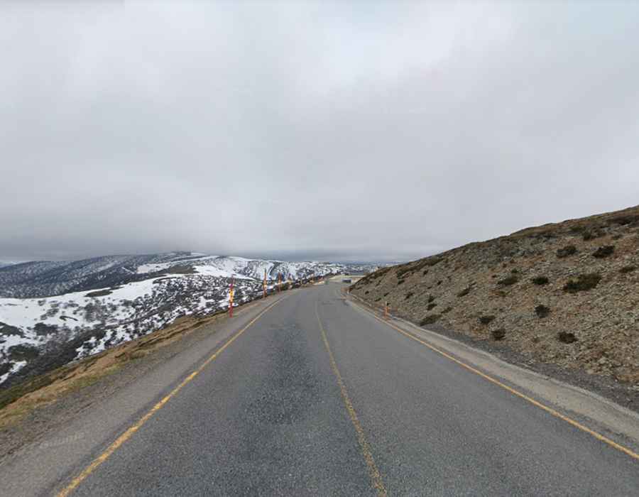
The road to the summit has been fully paved since 1997-98. It’s called Great Alpine Road (B500), the highest bitumen road in Australia. The Great Alpine Road (B500) is 303 km (188 mi) long.
Is Mount Hotham open?
Situated in the Victorian Alps of the Great Dividing Range, this road, also known as the GAR, is one of the highest roads in the country. It generally remains open during the winter, but snowfall can prompt closures, especially between Harrietville and Omeo. During the declared snow season, vehicles have to carry diamond-pattern snow chains. The route is subject to frequent snow during the winter and necessitates daily clearing. Despite regular maintenance, severe weather can lead to closures. Chains can be rented from either side of the road.
How long is Mount Hotham?
Spanning 32.6 km (20.25 miles), the pass connects Harrietville to Hotham Heights. While the climb from Harrietville to Mt Hotham isn't excessively steep, it requires attention. The road accommodates oncoming traffic, but in spots, it's a tight squeeze. Several sections have steep drop-offs right beside the road, and crash barriers aren't always present.