The Rugged 4x4 Road to Mount Matlock in Victoria
Mount Matlock is a mountain peak at an elevation of 1.372m (4,501ft) above sea level, located in the south of Victoria, in Australia.
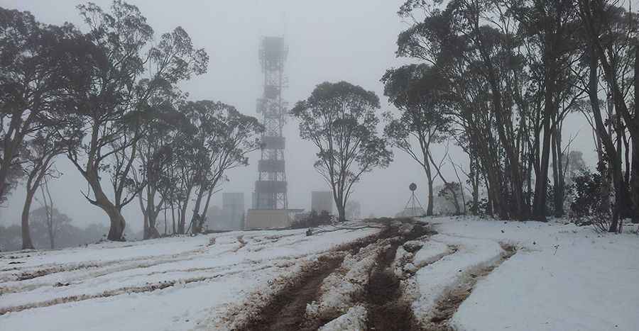
What’s on the summit of Mount Matlock?
At the summit, you'll find a 37-meter tall fire tower installed in 1994. It hosts several communication devices, although mobile phone service is unavailable. This tower replaced the original one that was built after the destructive 1939 Black Friday Fires.
Is the road to Mount Matlock in Victoria unpaved?
Located in the southern part of the country, the road to the summit is totally unpaved. It’s called Corn Hill Road. It’s a 4wd track.
How long is the road to Mount Matlock?
Located within the Yarra Ranges National Park, the road is 1.9 km (1.18 miles) starting from the C511 (Warburton-Woods Point Road). The elevation gain is 167 meters and the average gradient is 8.78%.
Pic&more info: https://waynemerry.wordpress.com/2012/08/11/sota-activations-of-mt-matlock-vk3vc-001-and-mt-toorongo-range-vk3vt-026/