How to get by car to Doi Inthanon, the highest mountain in Thailand?
Doi Inthanon is a high mountain peak at an elevation of 2,565m (8,415ft) above sea level, located in Mae Chaem District of Chiang Mai Province. It’s the highest mountain in Thailand.
Why is it called Doi Inthanon?
It is named after King Inthawichayanon, one of the last kings of Chiang Mai. He was dedicated to preserving the forests in northern Thailand, and the park honors his legacy.
How long is the road to Doi Inthanon?
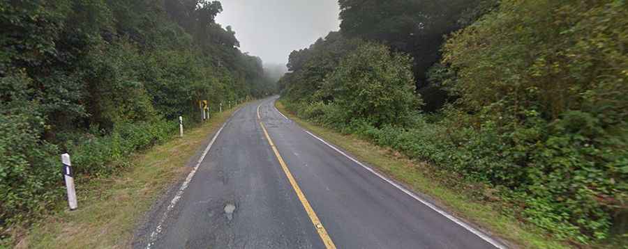
The road to the summit, known as "The Roof of Thailand," is fully paved. It is called Route 1009. It starts at Doi Inthanon National Park Check Point 2 and covers 9.1 km (5.65 miles) with an elevation gain of 868 meters. The road has an average gradient of 9.53%.
Is Doi Inthanon Worth Visiting?
Located in Doi Inthanon National Park, near the Myanmar border in the northern part of Thailand, the summit of Doi Inthanon is a popular tourist attraction. As you drive up, the temperature drops. At the summit you’ll find a souvenir shop, and find refreshments, snacks, and restrooms. During the wet season, the summit is often cloudy, limiting visibility. The national park has high humidity and cold weather year-round.
Is the road to Doi Inthanon open?
The road is usually open year-round, with possible surface frost near the summit between November and January. Due to temperature differences between high and low altitudes, Mount Doi Inthanon supports various types of forests. The lower part of the mountain has plants that thrive in high humidity and cold conditions. Unique plant species, including Sphagnum Moss and the Delavey Rhododendron, grow in these forests. Despite Thailand's generally hot weather, Mount Doi Inthanon stays cool due to its high altitude, and ice can sometimes form.