A journey on the legendary Pamir Highway to Kyzylart Pass
Kyzylart Pass is an international high mountain pass at an elevation of 4.292m (14,081ft) above sea level located on the Tajikistan-Kyrgyzstan border. It’s one of the highest roads of the country.
What’s the road through Kyzyl-Art Pass?
The pass, also known as Kyzyl Art, is one of the world's highest border crossings. The road through the summit is the infamous M41, also known as the Pamir Highway.
Is Kyzyl-Art Pass dangerous?
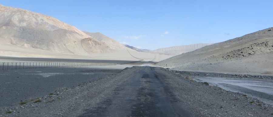
The road is not easy and very remote. It’s mostly unpaved and quite rugged. Along the way you’ll need to cross a few small creeks without bridges. The road has steep parts.
Is Kyzyl-Art Pass open in winter?
Due to heavy snowfalls, the pass is often closed during the winter months.
How long is the road through Kyzyl-Art Pass?
The pass is 223 km (138 miles) long, running north-south from Sary-Tash (a village in Kyrgyzstan's Alay Valley in the Osh Region) to Murghab (the capital of Tajikistan's Murghob District in the Gorno-Badakhshan Autonomous Region). Keep in mind that Sary Tash is small town but it has gas station, shops, and restaurants, so it’s a good place to rest or spend the night.
How to get ready to cross the border at Kyzyl-Art Pass?
The Kyzyl-Art Pass, particularly near the Tajik border control, is a remote and rocky area. If you don’t want to stay stuck between both countries in the 20km stretch of no man's land that separates Kyrgyzstan and Tajikistan, try to organize in advance the transportation. At the same time, remember that if you’ve the right visa, there should be no additional fees to the authorities. However, it's important to note that police officers, especially on the Tajikistan side, may try to scam travelers by fabricating requirements like health certificates to extort money. Remain vigilant and exercise caution in these circumstances.
Pic: 1959Patrizia