How to drive the mining road to Kumargh in Tajikistan?
Kumargh is a high- mountain peak at an elevation of 3,554m (11,660ft) above sea level, located in the Kuhistoni Mastchoh District of Tajikistan.
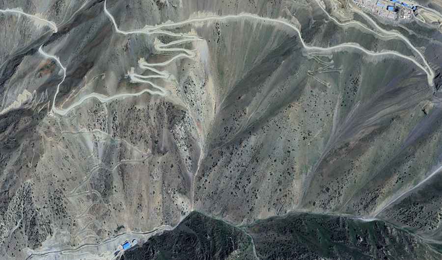
| Road facts: Kumargh (Mining Road) | |
|---|---|
| Location | Sughd Province, Tajikistan |
| Elevation | 3,554 m (11,660 ft) |
| Length | 16.3 km (10.12 miles) |
| Average Gradient | 10.52% |
Is the road to Kumargh unpaved?
The road to the summit is totally unpaved. It’s an industrial track serving the Kumarghi Bolo Gold Mine in the southern Sughd Province. The surface is often compressed but prone to deep rutting.
How long is the road to Kumargh?
Starting at the junction with the paved M34 Road, the road to the summit is 16.3 km long. Over this distance, the elevation gain is 1716 m and the average gradient is 10.52%.
How challenging is the road to Kumargh?
The road is difficult. It comprises narrow sections and extreme unprotected drops. It’s steep in parts, with several ramps exceeding 15%. The road is cut into the steep slopes of the Sughd mountains, where erosion frequently compromises the outer edges of the track.
Can I drive my vehicle to Kumargh?
A high-clearance 4x4 vehicle with a low-range gearbox is required. The track is subject to rapid weather changes.
Road suggested by: Hugh Wilson