The road to Kaindi in the Pamir Mountains will take your breath away
Kaindı is an international high mountain peak with an elevation of 4,915m (16,125ft) above sea level, situated on the border between China and Tajikistan.
Where is Kaindı?
The peak is positioned on the border between the Gorno-Badakhshan Autonomous Region of Tajikistan and the Xinjiang Autonomous Region of China. A military road on the Chinese side leads to the summit, while on the Tajik side, there is no road to the top.
How long is the road to Kaindi in the Pamir Mountains?
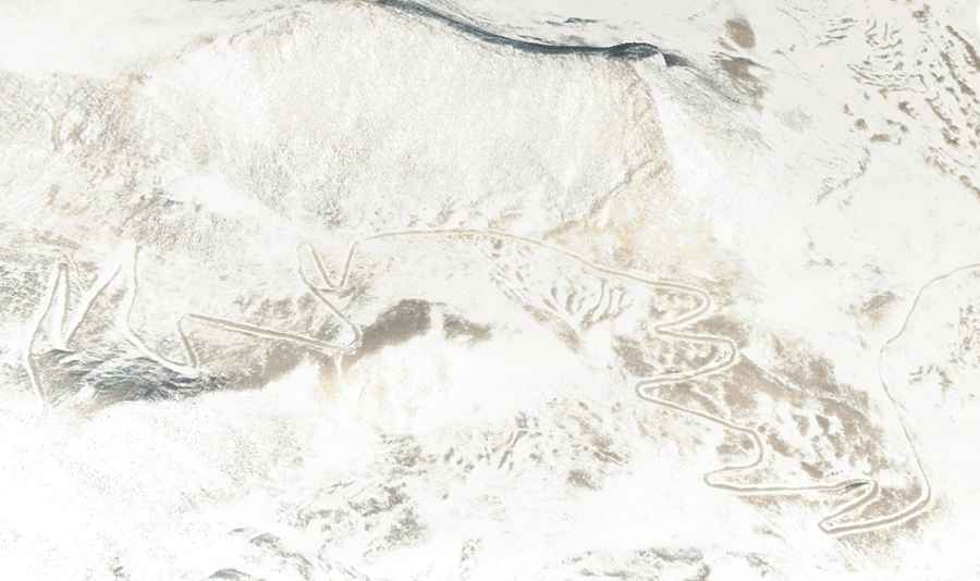
Commencing from Heiyeke, the road to the summit is entirely unpaved, spanning a length of 18.3 km (11.37 miles). The journey is notably challenging, featuring 28 hairpin turns and an elevation gain of 1,268m. The average gradient is 6.92%. Nestled high in the Pamir Mountains, attempting this route in anything but a high-clearance, preferably 4-wheel drive vehicle is a recipe for disaster. The road is typically impassable from late October through late June or early July. Given the high elevation, oxygen levels drop, requiring visitors to take adequate precautions against Acute Mountain Sickness (AMS).