What are the most spectacular roads in Tajikistan?
The Republic of Tajikistan is a landlocked country located in the central part of Asia. Due to its topography, the country is a paradise for 4x4 drivers and fans of high mountain roads. It’s worth noting that 93% of the country is covered by mountains.
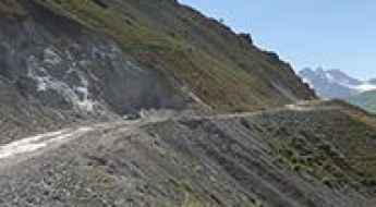
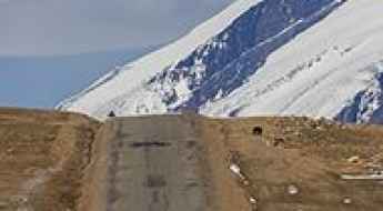
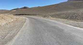
It’s not strange that the country hosts the highest road pass in the former Soviet Union, the Ak-Baital Pass, at an elevation of 4.670m (15,321ft) above sea level. It's also worth driving through the dangerous Anzob Pass. It is a mountain pass at 3.372m (11,062ft) above sea level. Due to its dangers, the pass was bypassed by the Anzob Tunnel, one of the most lethal tunnels in the world.
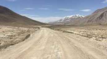
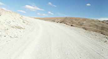
For the bravest drivers, the country hosts the Pamir Highway, the second highest altitude international highway in the world, an excellent challenge for 4x4 adventure travelers. Most of the road is paved (although in very bad conditions) and stretches more than 1,200km between Osh (in Kyrgyzstan) and Dushanbe (in Tajikistan) through the Pamir Mountains. The road is heavily damaged in places by erosion, earthquakes, landslides, and avalanches. The country shares borders with Kyrgyzstan, Uzbekistan, China, and Afghanistan, covering an area of 142,600 km2 (55,100 sq mi). Keep in mind that the country has a varied climate, ranging from subtropical in the lowlands to polar in the high mountains, so better check twice the weather before embarking on any road trip.
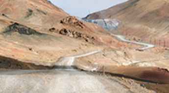
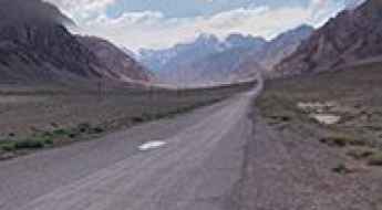
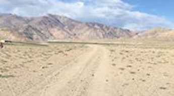
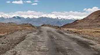
Pamir Highway is the second highest altitude international highway in the world
The historical Pamir Highway (M41) is an excellent challenge for 4x4 adventure travelers. Most of the road is paved (in very bad conditions) and stretches more than 1,200km between Osh (in Kyrgyzstan) and Dushanbe (in Tajikistan) through the Pamir Mountains. The road is heavily damaged in places by erosion, earthquakes, landslides, and avalanches.
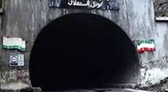
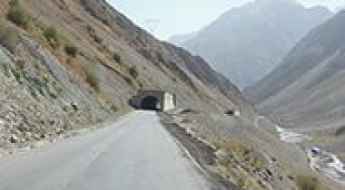
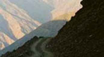
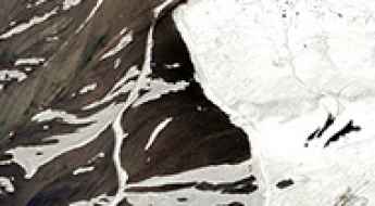
Inside Anzob Tunnel: Navigating the Perilous Tunnel of Death of Tajikistan
Located in the Sughd Region of Tajikistan, Anzob Tunnel is said to be the most dangerous tunnel in the world. Nicknamed the Tunnel of Fear and the Tunnel of Death by locals, it lacks proper lighting and ventilation, and breathing is hard and painful due to the thick mixture of exhaust gases.
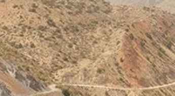
How to Survive and Drive through the Dangerous Anzob Pass in Tajikistan
Anzob Pass is a high mountain pass at an elevation of 3.372m (11,062ft) above sea level, located in the Sughd Region of Tajikistan. Due its dangerousness, the pass was bypassed by one of the most dangerous tunnels in the world. It’s a dark, dangerous place, with hardly any lights inside and it’s suffocating as there’s no ventilation except for one fan.
Ak-Baital Pass is the highest road pass in the former Soviet Union
Ak-Baital Pass is a high mountain pass at an elevation of 4.670m (15,321ft) above sea level, located in the Gorno-Badakhshan Autonomous Region of Tajikistan. At this elevation, it’s the highest road pass in the former Soviet Union.
A road with dramatic views to Khargush Pass in Tajikistan
Pereval Khargush is a high mountain pass at an elevation of 4.319m (14,169ft) above sea level, located in the Gorno-Badakhshan Autonomous Region of Tajikistan.
A paved border road to Kulma Pass in the Pamir Mountains
Kulma Pass is an international high mountain pass at an elevation of 4,362m (14,311ft) above sea level, located on the border of China and Tajikistan.
The formidable Khaburabot Pass is traversed by the Pamir Highway
Aghbai Khaburabot is a high mountain pass at an elevation of 3.852m (12,637ft) above sea level, located in the Gorno-Badakhshan region of Tajikistan.
Driving to Kok Jar Pass: A Road That Might Disappear Under Washouts
Kok Jar Pass is a high mountain pass at an elevation of 3,807m (12,490ft) above sea level, located in the Kūhistoni Badakhshon Autonomous Region of Tajikistan. The road may be impassable at times, even for 4×4 vehicles.
How to Get to Murghab, One of the Highest Towns Accessible by Car on Earth
Murghab is a high mountain town at an elevation of 3,618m (11,869ft) above sea level, located in the Murghob District of Gorno-Badakhshan Autonomous Oblast, in Tajikistan. It’s one of the highest towns accessible by car on Earth.
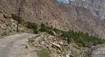
Travelling Through the Defiant Kulob-Qal'ai Khumb Road
Located in the southern part of Tajikistan, the Kulob-Qal'ai Khumb road is a very challenging drive, running closely along the Panj River and following the Afghan border.
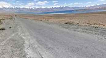
How to Get by Car to Karakul Lake in the Pamir Mountains
Karakul Lake is a high mountain lake at an elevation of 3,900m (12,800ft) above sea level, located in Gorno-Badakhshan, Tajikistan.
Driving the challenging Pamir Highway to Koitezyak Pass
Pereval Koitezyak is a high mountain pass at an elevation of 4,122m (13,523ft) above sea level, located in Gorno-Badakhshan Autonomous Region, Tajikistan.
Driving through Nayzatash Pass on the Pamir Highway
Pereval Nayzatash is a high mountain pass at an elevation of 4.134m (13,562ft) above sea level, located in the Gorno-Badakhshan Autonomous Region of Tajikistan.
M34 road: Driving the mountain highway from Dushanbe to Khujand
The M34 is a major highway in Tajikistan, running north-south to connect Dushanbe, the national capital, with Khujand, the country's second-largest city. The route is a primary transport link through the northwestern mountain ranges of the country.
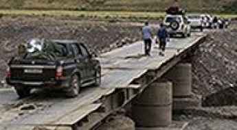
How to cross the narrow Khudkham River bridge?
Located in Tajikistan, the Khudkham River bridge is one of the most spectacular bridges in the world.
The breathtaking road to Pereval Kuruk
Kurgush Pass is a high mountain pass at an elevation of 4.083m (13,395ft) above the sea level, located within the Badakhshan National Park, in the Pamir Mountains of Gorno-Badakhshan Autonomous Region, Tajikistan.
Pereval Tagarkaty
Pereval Tagarkaty is a high mountain pass at an elevation of 4.160m (13,648ft) above the sea level, located within the Badakhshan National Park, in the Pamir Mountains of Gorno-Badakhshan Autonomous Region, Tajikistan.
Yashikul Lake
Yashikul lake is a fresh-water alpine lake at an elevation of 3.976m (13,044ft) above the sea level, located in Gorno-Badakhshan Autonomous Province, in southeast Tajikistan.
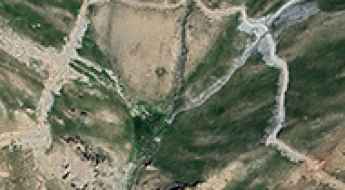
How to drive the unpaved road to Iskanderkul lake?
Iskanderkul is an alpine lake of glacial origin at an elevation of 2.242m (7,355ft) above sea level, located in Sughd province, in Tajikistan.
Pereval Oburdon
Pereval Oburdon is a high mountain pass at an elevation of 3.902m (12,801ft) above the sea level located in Sughd Region, in the northwest of Tajikistan.
Bulun Kul Lake
Bulun Kul Lake is a fresh-water alpine lake at an elevation of 3.751m (12,306ft) above the sea level, located in Gorno-Badakhshan Autonomous Province, in southeast Tajikistan.
How To Have The Ultimate Road Trip To Uy-Bulak Pass
Pereval Uy-Bulak is a high mountain pass at an elevation of 4.264m (13,989ft) above sea level, located in the Gorno-Badakhshan Autonomous Region of Tajikistan.
The road to Tuzanchi in the Pamir Mountains will take your breath away
Tuzanchi is an international high mountain peak with an elevation of 4.893m (16,053ft) above sea level, situated on the border between China and Tajikistan.
How to drive the unpaved mining road to Tagrich Pass?
Tagrich Pass is a high mountain pass at an elevation of 3,496m (11,469ft) above sea level, located in the Ayni District of Tajikistan. Situated in the southern part of the Sughd Province, the access via the western side is a technical mining road—also known as Pindor Pass—that requires high-clearance 4x4 vehicles to manage the extreme vertical gain and the primitive unpaved surface.
How to drive the mining road to Kumargh in Tajikistan?
Kumargh is a high- mountain peak at an elevation of 3,554m (11,660ft) above sea level, located in the Kuhistoni Mastchoh District of Tajikistan.
How to drive to Veshab Pass in the Sughd Province?
Pereval Veshab-Ovchi is a high mountain pass at an elevation of 3,793m (12,444ft) above sea level, located in Ayni District, in Tajikistan.
How to drive to Siyoh Pass in the Sughd Province?
Siyoh Pass is a high mountain pass at an elevation of 3.843m (12,608ft) above sea level, located in Kuhistoni Mastchoh District, in Tajikistan.