Badawi Pass is a difficult road for experienced drivers only
Badawi Pass is a high mountain pass at an elevation of 3.523m (11,558ft) above sea level, located in the Khyber Pakhtunkhwa province of Pakistan.
Where is Badawi Pass?
The pass is located in the northwestern part of the country and links Upper Dir District and Utror & Kalam.
How long is the road to Badawi Pass?
The pass is 42.7 km (26.53 miles) long, running west-east from Kalkot to Utror.
Is the road to Badawi Pass unpaved?
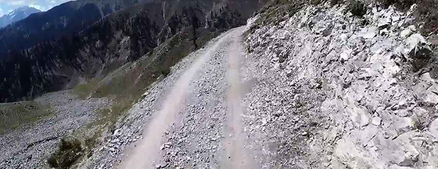
The rugged road to the summit, also known as Do Teer Pass, Badgoi Pass, and Badogai Pass, is entirely unpaved. It’s called Utrar-Dir Road. Be prepared; this road is not for the faint of heart or ill-prepared. The top of the pass, marked by the two-faced hill, offers scenic views of both the Swat and Dir Kohistan sides. A 4x4 vehicle with high clearance is required. Expect a trail that is pretty steep, with sections up to 29 percent. Drive with care, as this is a mountain road with hairpin curves and dangerous drop-offs.
Is Badawi Pass open in winters?
Set high on the border between Kumrat Valley and Kalam Valley, the road is usually impassable from November through June.
Pic: Travellers Club Pakistan