Driving the scenic Makran Coastal Highway
Running along Pakistan's Arabian Sea coastline, the Makran Coastal Highway is one of the most scenic coastal drives in the world.
How long is the Makran Coastal Highway?
The road, officially known as National Highway 10 (N10), is totally paved. It’s 683 km (424 miles) long, running from Karachi in Sindh province (the largest city in Pakistan) and extending to Gwadar (a strategically important port city in Balochistan province). It then continues further westward, connecting several other towns and cities along the coast, including Ormara and Pasni, before reaching the border with Iran.
How challenging is the Makran Coastal Highway?
While the highway provides essential connectivity, it also presents challenges due to its remote and isolated location, harsh climate conditions, and limited infrastructure development. The road tops out at 323m (1,059ft) above sea level, by Buzi Pass. The road is pretty defiant, cut through often impossible terrain. It is narrow and often steep. The region is prone to extreme weather events, including cyclones and flash floods, which can affect road conditions and safety. Additionally, the highway passes through sparsely populated areas with limited access to services such as fuel stations and rest stops, making it important for travelers to plan their journey carefully and ensure they have adequate provisions.
Is the Makran Coastal Highway worth it?
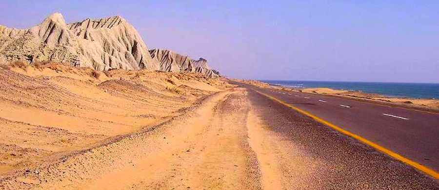
Running along the southwestern coastline of the country, particularly in the province of Balochistan, it offers stunning views of the Arabian Sea, with picturesque landscapes featuring rugged cliffs, sandy beaches, and rocky terrain. Travelers often appreciate the natural beauty along the route, making it a popular destination for tourists, particularly those interested in coastal scenery and marine activities. Despite its challenges, the Makran Coastal Highway has significant tourism potential due to its scenic beauty and unique coastal landscape. Efforts to promote tourism along the route have been made to attract visitors and boost economic activity in the region. Tourists can explore attractions such as pristine beaches, fishing villages, historical sites, and cultural landmarks along the coastline.
When was the Makran Coastal Highway built?
Construction of the road, also known as Balochistan Coastal Highway, started in 2002 and was completed by 14 December 2004. It follows a route once taken by Alexander the Great's army. Over the years, there have been efforts to improve and upgrade the Makran Coastal Highway to enhance its safety, accessibility, and efficiency. These efforts include road maintenance, construction of bridges and tunnels, and implementation of safety measures to mitigate risks associated with natural disasters and accidents.
Why is the Makran Coastal Highway very important?
The road is truly a symbol of pride for all Pakistanis. Previously, there was a muddy track linking Karachi with the town of Gwadar. The construction of the road was essential to the development of the port of Gwadar. The highway serves as a vital transportation artery, facilitating trade, commerce, and travel between various regions in Pakistan, as well as with neighboring countries such as Iran and Afghanistan. It plays a crucial role in connecting Gwadar Port, which is a key component of the China-Pakistan Economic Corridor (CPEC), to the rest of the country.
Pic: http://www.tresbohemes.com/2015/05/makran-coastal-highway/