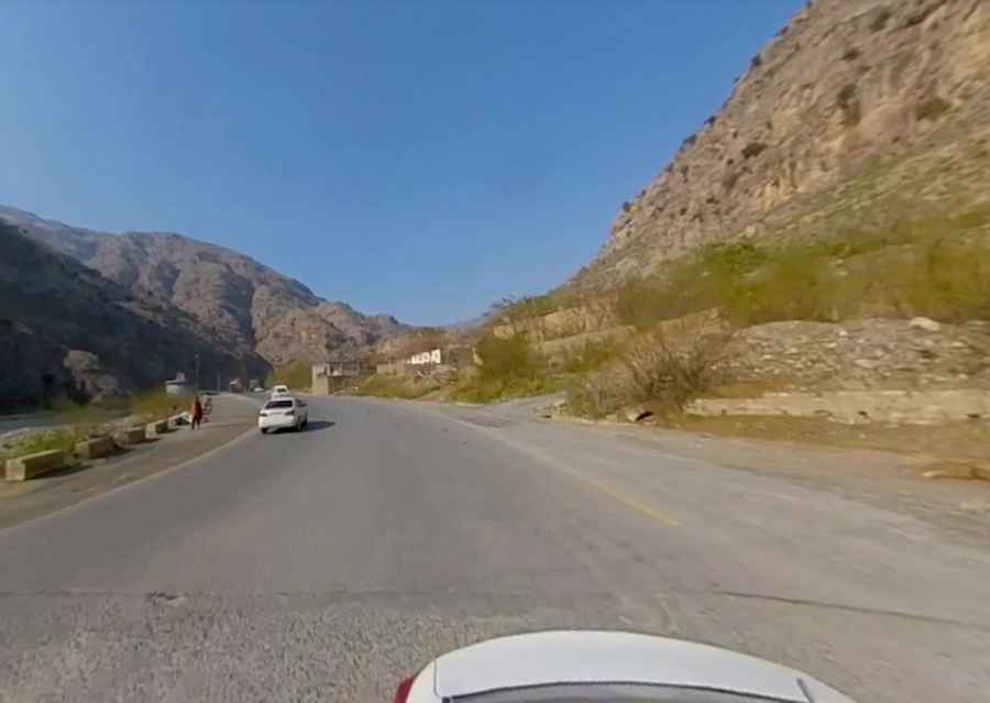
The paved Khyber Pass is part of the Silk Road
Khyber Pass is a high mountain pass at an elevation of 1,070m (3,510ft) above sea level, located in the Khyber Pakhtunkhwa province of Pakistan. The road through the pass is the main route between Pakistan and Afghanistan.
Why is Khyber Pass so famous?
Located in the northwestern region of the country, the pass is the most northerly and important of the passes between Afghanistan and Pakistan. It has long been a significant trade and invasion route. Well-known invasions of the area have been predominantly through the pass. It is the scene of various historic battles and one of the routes once known as “the Silk Road”. The area between Peshawar and Afghanistan is known as the tribal lands.
Is it safe to go to Khyber Pass?
Traveling to this area is not recommended, as the area is not safe. A place where tribal warlords ruled. Here neither the police nor the Pakistani army have any jurisdiction whatsoever. At the top of the pass is the town of Landi Kotal, famous for smuggling everything from consumer electronics to AK-47s. Attractions for the truly intrepid tourist include weapons factories and hashish warehouses. Alongside the dusty road are corrugated metal rooftop storefronts. Here it isn't milk powder nor water they sell. Here, they sell wholesale weaponry. AK-47s by the dozen, or maybe a single pistol for a single job. Grenades, mortars, not a problem. Discounts available. Next door it’s a different kind of merchandise. Hashish by the ounce, kilo, or bale. Opium for export and cocaine for retail. The pass is clearly far too dangerous for most.
How long is Khyber Pass?
Set high on the northeastern part of the Spin Ghar mountains, the road to the summit is completely paved. It’s called N5 Torkham Highway, part of the Grand Trunk Road. The pass is 32.0 km (19.88 miles) long running east-west from Shalkani to the border of Afghanistan.
Pic: Shakeel Afridi