Road trip guide: Conquering Nathia Gali in Pakistan
Nathia Gali is a mountain resort town at an elevation of 2,450m (8,038ft) above sea level, located in the Abbottabad District of Khyber Pakhtunkhwa, Pakistan.
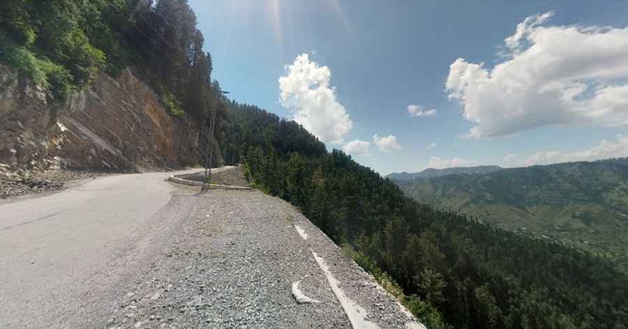
How is the road to Nathia Gali?
Located within the Ayubia National Park, the road to the hill station, also known as Nathiagali, is completely paved but very curvy. It’s called Nathia Gali road. Nathia Gali is famous for its lush green meadows, deep forests of oak, cedar, and pine, where fog in July/August presents a scenic glory. In winter, snowfall adds to the scenery.
How long is the road to Nathia Gali?
Surrounded by walnut, maple, and oak trees, the road is 46.4 km (28.83 miles) long, running from south to north, Kuldana to Bagnotar. To drive the road without stopping will take most people between 1.5 and 2 hours, unless there is a lot of traffic.
When is the best time to drive to Nathia Gali?
Situated at the center of the Galyat range, the weather in this area is harsh and highly unpredictable. Nathiagali experiences cool, pleasant, and foggy weather in summers (1 May to 31 August). During the Monsoon season (1 July to 16 September), rain is expected almost every day. Cold winds start to chill the weather in autumn. Winters (1 November to 28 February) are very cold and chilly. In December and January, heavy snowfall occurs here, blocking the road leading to Nathiagali. The weather remains cold in spring. The most comfortable weather is during the summer season.
Pic: Ummar Hussain