Driving the steep unpaved 4x4 track to Sumari in Gilgit-Baltistan
Sumari is a high mountain village at an elevation of 2,675 meters (8,776 feet) above sea level, located in the Gilgit District of Pakistan-administered Gilgit-Baltistan, within the disputed Kashmir region.
| Road facts: Sumari | |
|---|---|
| Location | Gilgit District, Gilgit-Baltistan, Pakistan |
| Elevation | 2,675 m (8,776 ft) |
| Length | 10.0 km (from S1 Baltistan Highway near Sassi) |
| Hairpin Turns | Over 30 |
| Max Gradient | 14% |
| Surface | Unpaved dirt and loose stone |
Is the road to Sumari unpaved?
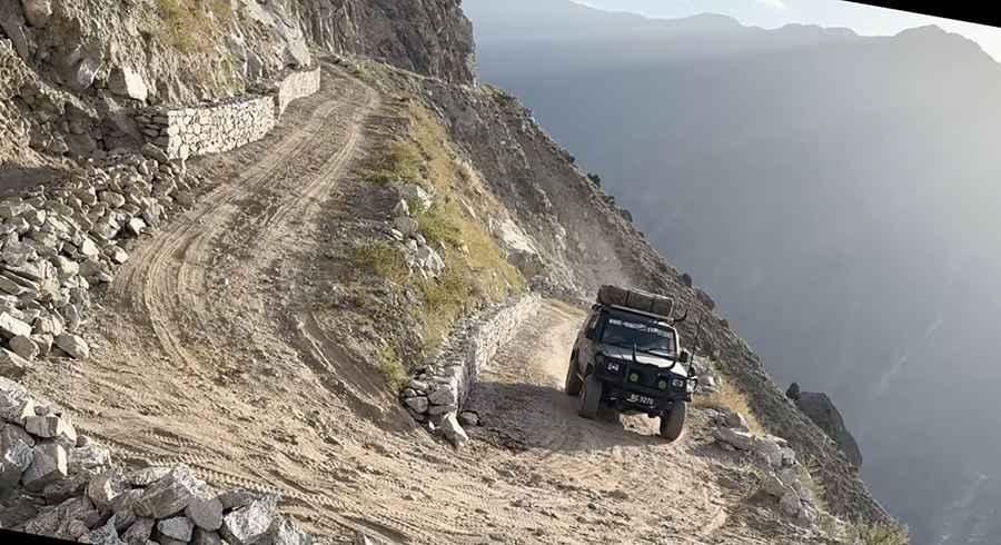
Set high in the northern mountains, the road to the village is a dusty, narrow dirt track supported only by dry-stone retaining walls. It has no guardrails and runs alongside sheer, unprotected drops. The climb tackles more than 30 tight hairpin turns with steep ramps hitting a 14% maximum gradient.
Can I drive my vehicle on the road to Sumari?
Cut directly into the vertical mountainside, this single-lane shelf road has almost no room for passing oncoming traffic. The track is passable only by high-clearance 4x4 vehicles with low-range gearing and experienced drivers.
How long is the road to Sumari?
Starting from the paved S1 (Baltistan Highway) near Sassi, the climb to the village is 10 km (6.2 miles) long.
Road suggested by: Hugh Wilson
Pic&video: Wasi Malik vlogs