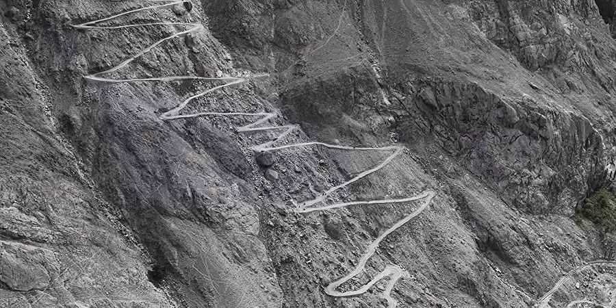
Are you able to drive the 39 hairpin turns on the Rganostor Road?
Rganostor is a small high-mountain hamlet at an elevation of 2,906m (9,534ft) above sea level, located in the Skardu District of Pakistan. Access to the town is via a narrow, unpaved shelf road carved into the cliff face, featuring steep rock walls on one side and a sheer, unprotected vertical drop-off on the other.
Where is Rganostor?
The town is located in the Rganostor Valley, within the Pakistan-administered Gilgit-Baltistan region of disputed Kashmir, in the northeastern part of the country.
Is the road to Rganostor unpaved?
The road to the town is entirely unpaved, narrow, and extremely steep. This treacherous shelf road is carved directly into the mountain wall, bordered by a sheer, unfenced vertical drop-off that leaves no room for driver error.
How long is the road to Rganostor?
Starting from Thorgu on the Kargil Highway, the road to the town is 5.9 km long. Over this distance, the elevation gain is 619 m, with an average gradient of 10.49%.
Road suggested by: Hugh Wilson
Pic & video: Adam Riemann