Jambatai Pass: Driving the technical 4x4 road in Khyber Pakhtunkhwa
Jambatai Kandao, also known as Jambatai Pass, is a mountain pass at an elevation of 2,232 meters (7,322 ft) above sea level, located in the Khyber Pakhtunkhwa province of Pakistan. The mountain track cuts across the rugged ridges of the northwestern frontier sector.
| Road facts: Jambatai Kandao | |
|---|---|
| Location | Khyber Pakhtunkhwa (Pakistan) |
| Elevation | 2,232 m (7,322 ft) |
| Length | 15.9 km (9.87 miles) from Hido to Damtal |
| Surface | Unpaved (Dirt, gravel, and loose rocks) |
Where does the road through Jambatai Kandao run?
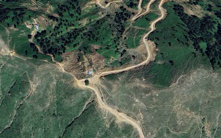
The unpaved mountain road spans 15.9 kilometers (9.87 miles), running north to south to connect the rural settlements of Hido and Damtal. The single-lane track climbs directly along the steep, unprotected ridges of the Hindu Kush foothills, reaching its highest point at the 2,232-meter pass summit crest. The entire 15.9-kilometer alignment consists of a narrow dirt lane completely devoid of roadside facilities, fuel stations, or light systems.
What are the driving hazards along the Jambatai Pass?
The trackbed is entirely unpaved, consisting of a low-traction base filled with loose gravel ruts, deep mud channels, and sharp stones. The single lane features dozens of tight hairpin turns and narrow blind corners carved into raw cliff faces with zero side safety barriers or guardrails. Due to the steep climbing ramps and the unstable stone edges that crumble under vehicle weight, a high-clearance 4x4 vehicle is required to navigate the sector safely without striking the chassis components.
Is the road to Jambatai Kandao open in winter?
Due to its alpine altitude in northern Pakistan, the pass faces severe winter freeze cycles, remaining frequently blocked by heavy snow drifts and thick ice from December until late March. During the summer operational window, the track is highly subject to sudden rockfalls and major landslides triggered by monsoon rains in July and August, which turn the unpaved clay base into thick, deep mud traps and create fast-flowing water crossings across the lane floor.
Road suggested by: Hugh Wilson