How to drive the road to Mukha Pass between Afghanistan and Pakistan
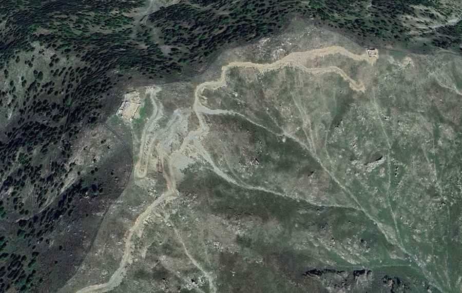
Mukha Pass is an international high mountain pass at an elevation of 2,564m (8,412ft) above sea level located on the border of Afghanistan and Pakistan.
Where is Mukha Pass located?
The pass is located on the border between the Kunar Province of northeastern Afghanistan and the Khyber Pakhtunkhwa province of northwestern Pakistan.
| Road facts: Mukha Pass | |
|---|---|
| Elevation | 2,564 m (8,412 ft) |
| Distance | 22.8 km (14.16 miles) |
| Surface | Unpaved / Military Track |
| Access | Restricted / Military use only |
How long is the road to Mukha Pass?
On the Pakistani side, the road to the summit is 22.8 km (14.16 miles) long starting from Mamund. The road is an unpaved military track with multiple hairpin turns and narrow sections. While the Pakistani side maintains a formal track for military logistics, there is no road infrastructure on the Afghan side of the pass.
Can I drive to Mukha Pass?
Set high in the Hindu Kush mountain range, the pass is a restricted zone. Access it is restricted to military personnel and the road is not open to foreign nationals or civilian transit. Travel to this area is strongly discouraged by international authorities due to ongoing security operations and regional instability. Permits for the surrounding areas are strictly controlled by the respective governmental bodies. The route contains several military installations and checkpoints to monitor border security.
Road suggested by: Hugh Wilson