Bolan Pass is a gateway to and from South Asia
Bolan Pass is a high mountain pass at an elevation of 1.793m (5,884ft) above sea level located in Pakistan. The pass has been used as a gateway to and from South Asia.
Where is Bolan Pass?
The pass is located in the Balochistan province, in the southwestern part of Pakistan, 120 kilometres away from the Afghanistan border. Strategically located, it is one of the two main routes from Afghanistan into the Indian subcontinent, along with the Khyber Pass further north.
Is Bolan Pass paved?
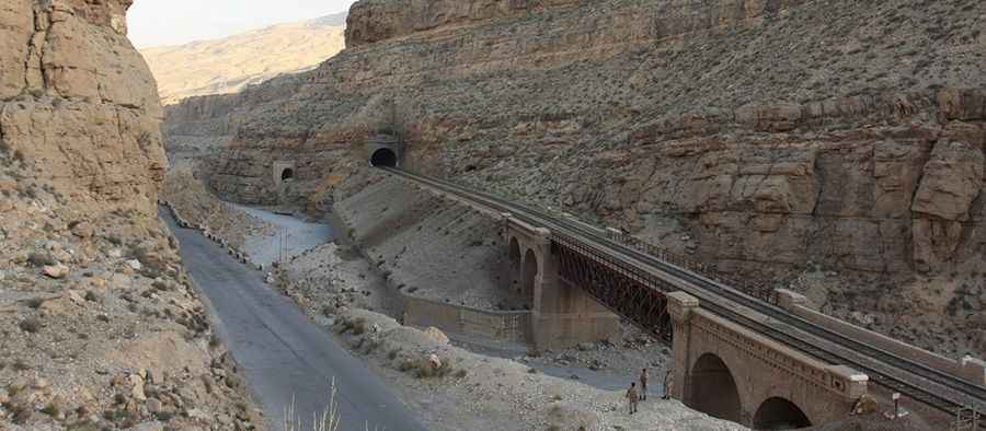
Set high in the Toba Kakar Range, south of the Hindu Kush mountain ranges, the road to the summit is totally paved. It’s called N65 (Quetta - Jacobabad Highway).
How long is Bolan Pass?
The pass is 141 km (87.61 miles) long, running from Quetta to Sibi. This area is definitely not safe.
Which areas does Bolan Pass connect?
It's important to be prepared on this road. At a distance of 120 km from the border of Afghanistan, Bolan Pass connects Jacobabad and Sibbi to Quetta city. This pass has a significant historical background being a mountain pass that connects Central Asia and South Asia for traders, invaders, and nomadic tribes. Along Bolan Pass, where the road winds through picturesque mountains, one is reminded of the huge odds that the armies from Central Asia and the South must have faced in their raids on the plains of present-day Pakistan.
Pic&more info: http://odysseuslahori.blogspot.com.es/2013/04/BolanPass.html