A Road Through History to Haji Pir Pass
Haji Pir Pass is a high mountain pass at an elevation of 2,640m (8,661ft) above sea level, located in Azad Kashmir, Pakistan.
Why is Haji Pir Pass Famous?
The pass lies near the Indian border in the northeastern part of Pakistan. It was famously captured by the Indian Army during the 1965 war but was returned to Pakistan five months later under international pressure.
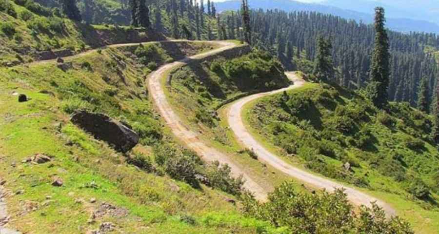
Is the Road Through Haji Pir Pass Unpaved?
Set high in the western Pir Panjal Range within the Inner Himalayas, the road to the summit is entirely unpaved and features countless curves and hairpin turns. It’s usually impassable in winter.
Where is Haji Pir Pass?
The pass is on the road connecting Poonch (the capital of Poonch District in the Indian Union Territory of Jammu and Kashmir) with Uri (a town in the Baramulla District, also in Jammu and Kashmir).
Road suggested by: Jorge Manuel Gómez Sánchez
Pic: Abrar Malik