What are the most spectacular roads in Pakistan?
Home to K2, the second highest peak in the world, Pakistan is a very mountainous country, located in the southern part of Asia. The country is a paradise for 4x4 mountain lovers, as it comprises the Himalayas, the Karakorams, and the Hindu Kush mountain ranges.
The country covers an area of 881,913 km2 and it’s bordered by India, Afghanistan, Iran, and China. However, due to the situation of the country, traveling there is not advised. If you travel to Pakistan, you should remain cautious and vigilant, including in major cities. There is a high threat of terrorism. The security situation is fragile and unpredictable. Several terrorist groups are present and operate across the country. If you take the risk, the country is home to countless mountain roads as well as a coastline along the Arabian Sea, providing beautiful coastal drives.
Speaking about roads, when traveling to Pakistan you can’t miss the treacherous Fairy Meadows Road. Located in the Gilgit-Baltistan region, the unpaved road is completely unmaintained, with no guardrails to protect you, and it gets so narrow that near the end, you’ll have to cover the last section by walking or biking. It’s also worth driving to Khunjerab Pass, the highest border crossing in the world, sitting at an elevation of 4,706m (15,439ft) above sea level, on the border with China. Babusar Pass is a mountain pass at 4,179m (13,710ft) above sea level on the boundary between Khyber Pakhtunkhwa and Gilgit-Baltistan provinces. It’s one of the most hairpinned roads in the world. And if you’re brave enough, try the Khaltaro Valley Road. Imagine a narrow gravel road, very steep (up to 15%) with horrendous drops on both sides. Welcome to hell! Only the suicidal, the insane, or the paid-to-do-this should ever drive down.
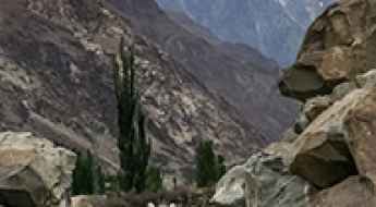
The Road to Chitral Gol National Park: How to get there by car?
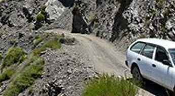
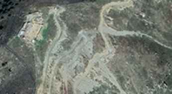
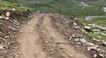
Located in the heart of the Hindu Kush Range, the road to Chitral Gol National Park is a high-altitude expedition in the Khyber-Pakhtunkhwa province of northern Pakistan. Reaching an elevation of 2,940m (9,645ft), this is a track where the beauty of the landscape is only matched by the technical difficulty of the terrain.
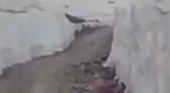
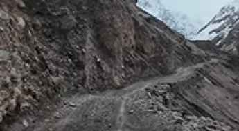
Supat Gali is one of the gnarliest roads of Pakistan
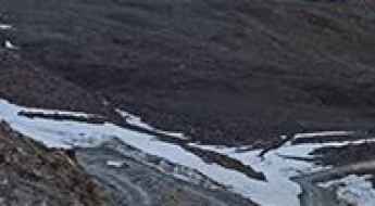
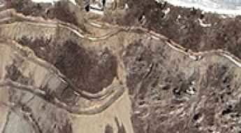
Supat Gali is a high mountain pass at an elevation of 4.285m (14,058ft) above the sea level, located in Khyber Pakhtunkhwa province, in Pakistan.
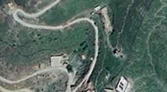
The road to Brithawari Gali: 35 hairpins to the top
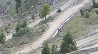
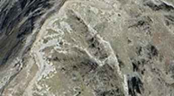
Brithawari Gali is a high mountain pass at an elevation of 2.995m (9,826ft) above sea level, located in Azad Kashmir, Pakistan.
Crossing the Naltar River Bridge: A Thrilling Journey
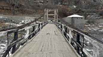
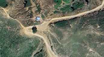
The Naltar River Bridge is no walk in the park. This high mountain bridge sits at an elevation of 2,386 meters (7,828 feet) above sea level, nestled in the Gilgit District of the Gilgit–Baltistan territory in Pakistan. It’s one of the most spectacular bridges in the world.
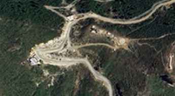
Spat Gali
Spat Gali is a high mountain pass at an elevation of 4.260m (13,976ft) above the sea level, located in Mansehra District of Khyber Pakhtunkhwa province of Pakistan.
Driving the Challenging Road to Ghakhai Pass
Ghakhai Pass is an international high mountain pass at an elevation of 2,082m (6,830ft) above sea level, located on the border between Afghanistan and Pakistan.
How to drive in Pakistan?
Located in South Asia, at the crossroads of the Middle East, Central Asia, and East Asia, Pakistan includes many challenges for drivers. It’s a country with demanding road conditions and significant safety concerns.
How to drive the unpaved road to Kalpani Pass in Upper Dir
Kalpani Kandao is a high mountain pass at an elevation of 2,206 meters (7,237 ft) above sea level, located in the Khyber Pakhtunkhwa province of Pakistan.
How to drive the road to Mukha Pass between Afghanistan and Pakistan
Mukha Pass is an international high mountain pass at an elevation of 2,564m (8,412ft) above sea level located on the border of Afghanistan and Pakistan.
Driving the unpaved border road to Totiano Pass
Totiano Pass (also known as Totiano Kandao) is an international high mountain crossing reaching an elevation of 2,418m (7,933ft) above sea level, situated on the volatile border between Afghanistan and Pakistan. Connecting the Kunar Province with Khyber Pakhtunkhwa, the road is a critical but high-risk logistical corridor in the Hindu Kush region.
Warghle Pass: A Forbidden Military Ascent in the Hindu Kush
Warghle Pass is an international high mountain pass at an elevation of 2,222m (7,290ft) above sea level, situated on the rugged Durand Line—the border between Afghanistan’s Kunar Province and Pakistan’s Khyber Pakhtunkhwa.
Jambatai Pass: Driving the technical 4x4 road in Khyber Pakhtunkhwa
Jambatai Kandao, also known as Jambatai Pass, is a mountain pass at an elevation of 2,232 meters (7,322 ft) above sea level, located in the Khyber Pakhtunkhwa province of Pakistan. The mountain track cuts across the rugged ridges of the northwestern frontier sector.
How to drive the unpaved road to Patlian Pass in Kaghan Valley?
Patlian Pass is a high-altitude mountain pass at an elevation of 4,261m (13,979ft) above sea level, located on the mountain ridge that divides the Kaghan Valley (Khyber Pakhtunkhwa) and the Neelum Valley (Azad Kashmir) in northern Pakistan.
How to drive the Chapursan Valley Road in Gilgit-Baltistan?
The Chapursan Valley Road is a high mountain track located in the Gojal region of Gilgit-Baltistan, Pakistan, near the Afghan border. The road is a raw, unpaved track where river crossings and loose shale are the main obstacles for any vehicle.