How to drive the steep road to Sang Da La?
Sang Da La is a high mountain pass at an elevation of 5,310m (17,421ft) above sea level, located in the Mustang District of Nepal. It is one of the highest roads in Nepal.
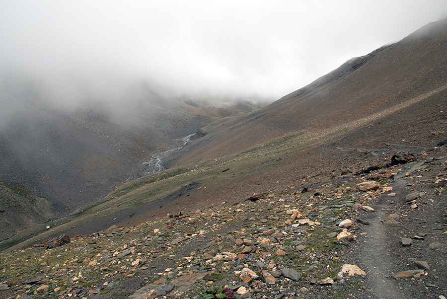
Is the road to Sang Da La Unpaved?
The road to the summit is totally unpaved, and very challenging, with 25% ramps. The terrain consists of loose scree on sharp bends with vertical drops. There are no safety barriers, and the edge of the track is often unstable, especially after the monsoon rains wash away parts of the roadbed.
How long is the road to Sang Da La?
The road is 15.4 km long, starting from Sangda and gains 2,070 meters of elevation. While the average gradient is 13.44%, the 25% ramps are the main obstacle for traction. On these steep sectors, the road is narrow and lacks a shoulder, with deep gullies carved by water runoff. You need a high-clearance 4x4 to avoid bottoming out on the sharp rocks that litter the track.
How remote is the road to Sang Da La pass?
Located near the Chinese border, there are no workshops or mechanical aid points in this sector of Mustang; if the engine fails, the vehicle will be stranded in an isolated border area.
Is the Sang Da La pass open during the winter?
At this elevation, the track is blocked with snow from December to April. The pass is only driveable between late April and June, or from September to November. Even in summer, blizzards can bury the road in minutes.
Pic: Sergey Pashko