What are the most spectacular roads in Nepal?
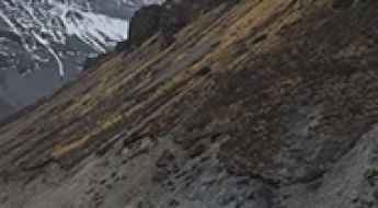
Set high in the Himalayas, Nepal is home to the highest mountain in the world, Mount Everest. The country is very mountainous, and so are most of the roads in the country, climbing up to stunning elevations. So, when traveling to Nepal, get ready to experience countless 4x4 adventures like never before. Most of them are very risky, so you’ll need to drive carefully. You can start with the Manang Road, a dangerous drive leading to Manang, a small mountain town at an elevation of 3,776m (12,388ft) above sea level, located in Gandaki Province.
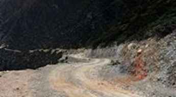
Bordered by China and India, the country covers an area of 147,516 square kilometers. Nepal is known for its mountainous terrain, with eight of the world's ten highest peaks located within its borders. Due to the difficult topography of the country, many roads are very dangerous: the amazing BP Highway, where you have to be careful as the road with sharp turns is pretty narrow; Arniko Highway, the road where ‘one mistake, game over,’ that provides Nepal’s overland link with Tibet and China; or the Karnali Highway, a true lethal adventure. Due to its danger, the police have banned driving at night on this road due to the high number of fatal accidents. The landscape is characterized by deep valleys, glaciated peaks, and fast-flowing rivers
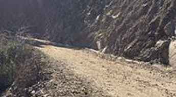
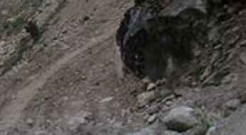
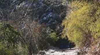
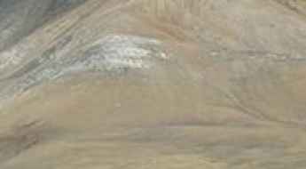
Driving the road to Supa Deurali Temple is not a piece of cake
Located in Nepal, Supa Deurali Temple (Supa Deural Mandir) is a mountain temple at an elevation of 1,509m (4,950ft) above sea level.
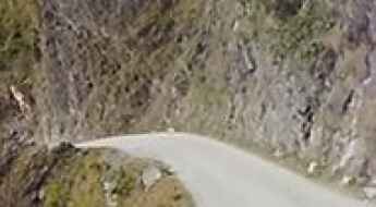
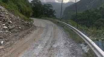
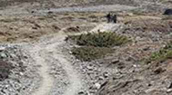
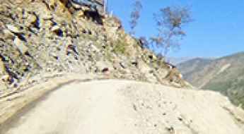
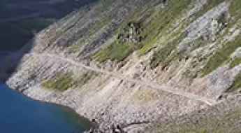
Don’t glance down at your phone on Manang Road
Manang is a small mountain town at an elevation of 3,776m (12,388ft) above sea level, located on the boundary between Lamjung and Manang districts of Gandaki Province, in Nepal.
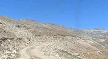
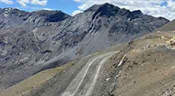
Driving the amazing BP Highway in Nepal
Located in the heart of eastern Nepal, BP Highway is a very scenic journey with stunning views. You have to be careful on your drive as the road, with sharp bends, is narrow.
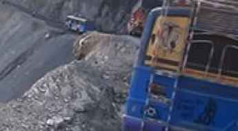
Dramatic views along the Prithvi Highway
Prithvi Highway, situated in Nepal, is a notoriously challenging road. Known for its hazardous conditions, it poses risks to drivers navigating its twists and turns.
Arniko Highway: One mistake, game over
The infamous Arniko Highway is one of the most dangerous roads in the world. It provides Nepal’s overland link with Tibet and China. "One mistake, game over".
Karnali Highway is a true lethal adventure in Nepal
Tucked away in the Karnali Region of Nepal, Karnali Highway is said to be one of the most dangerous roads in the world. The police have banned driving at nights on this road due the high number of fatal accidents.
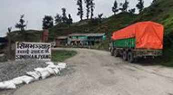
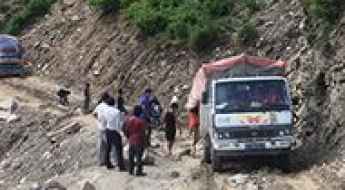
Potholes and turns on the road to Simbhanjyang Pass in Nepal's Mountains
Simbhanjyang Pass is a high mountain pass at an elevation of 2.488m (8,162ft) above sea level, located in the Bagmati Province of Nepal. The road is narrow and riddled with potholes. As a result, vehicles on the edge of the road lose control.
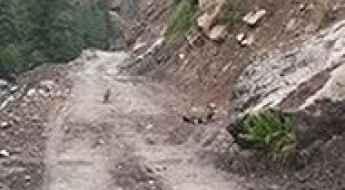
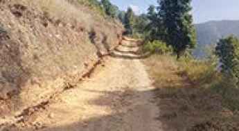
F042 is a challenging off-road experience from Baglung to Kagbeni
F042 is a highly challenging road located in the heart of the Mustang District of western Nepal. If you're afraid of heights, it's probably best to keep your eyes forward.
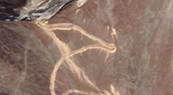
Driving the dangerous road from Rudrabeni to Ridi along the Kali Gandaki River
Located in the Lumbini Zone of central Nepal, the road from Rudrabeni to Ridi is one of the most dangerous roads in the world. This route is not recommended if your passengers are prone to car sickness.
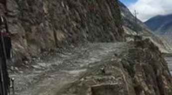
Kaligandaki Road: Driving the Unpaved Track over 9 Passes to Kora La
The Kaligandaki Road is a high-altitude unpaved mountain track located in the Mustang District of Nepal. Built by the Nepal Army, this 103 km (64 miles) dirt route cuts through the high-desert region of Upper Mustang, connecting the settlement of Kagbeni with the Chinese border post at Kora La.
Driving the Paved NH 109K Road in Uttarakhand is Not a Good Idea
NH 109K is the name of a paved road located in the state of Uttarakhand, in India. If your GPS ever thinks it's a good idea to drive on this road, it may be time to get a new one.
How to Get by Car to Jumla Airport in Nepal?
Jumla Airport is a high-mountain airport at an elevation of 2,347m (7,700ft) above sea level, located in the Jumla District in Province No. 6 of Nepal.
An Explorer's Guide to Thorong La Pass
Thorong La is a high mountain pass at an elevation of 4,514m (14,809ft) above sea level, located in Mustang District in the Dhaulagiri Zone of Nepal.
How to get by car to Chandragiri Hill, one of Nepal’s most loved day-trip destinations?
Chandragiri Hill is a high mountain peak at an elevation of 2,553 m (8,375 ft) above sea level, located in Kathmandu District in Bagmati Pradesh of Nepal. It’s one of the most iconic and touristic places in the Kathmandu Valley.
An ancient salt trade route to Nara La
Nara La is a high mountain pass at an elevation of 4.507m (14,786ft) above sea level, located in the Karnali Zone of Nepal.
A memorable road trip to Imja Khola
Imja Khola is a high mountain glacier on the slopes of Mount Everest, in the Nepalese Cukung Valley, at an elevation of 5.156m (16,916ft) above sea level. It's located in the Taplejung District of Koshi Province.
The wild road to Tipta La
Tipta La is an international high mountain pass at an elevation of 5,118m (16,791ft) above sea level, located on the border of China and Nepal. It’s an important trade route. It's one of the highest roads in the country.
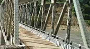
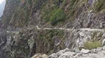
How to cross the narrow Keladighat Bridge in Nepal
Located in the Western Region of Nepal, the narrow Keladighat Bridge is one of the most spectacular bridges in the world.
Nyalu Lagna Pass
Nyalu Lagna Pass is a high mountain pass at an elevation of 4.995m (16,387ft) above sea level, located in the Karnali Province of north-western Nepal. It's one of the highest roads in the country.
Namja La: The remote Himalayan trade route at 5,005m
Situated in the heart of the rugged Himalayas, Namja La (also known as Nangsa La) is an international high mountain pass reaching a staggering elevation of 5,005m (16,420ft) above sea level. This pass serves as a vital but isolated gateway on the border between north-western Nepal and China’s Tibet Autonomous Region. It's one of the highest roads in the country.
How to drive the unpaved road to Pulchoki Peak?
Pulchoki Peak is a high mountain peak at an elevation of 2.757m (9,045ft) above sea level, located in Lalitpur District in Bagmati Pradesh, in Nepal.
Siyaba La: Driving the unpaved 4,847m military road in Mustang
Siyaba La, also known as Sharba La, is a high mountain pass at an elevation of 4,847 meters (15,902 ft) above sea level, located on the international border between the Mustang District of Nepal and the Xigazê Prefecture of the Tibet Autonomous Region, China. Set high in the rugged ridges of the Himalayas, the pass is crossed by an unpaved military frontier track.
The sauvage road to Latha Bhanjyang
Latha Bhanjyang is a high mountain pass at an elevation of 2.112m (6,929ft) above the sea level, located in Lalitpur District in Bagmati Pradesh of Nepal.
How to drive the military track with 75 hairpins to Lajyung La?
Lajyung La (also referred to as Lachung La or Lajin La) is an international high mountain pass at an elevation of 5,000m (16,404ft) above sea level, situated on the border between China (Tibet Autonomous Region) and Nepal (Gorkha District). Logistically, this is one of the highest roads in Nepal and China. While the Nepalese side lacks any motorable infrastructure, the Chinese side features a strictly regulated military road that starts from Ru Village in Gyirong County. Access is restricted and requires high-altitude 4x4 equipment.
Travel guide to the top of Chyangchumi La
Chyangchumi La is an international high mountain pass at an elevation of 5.177m (16,984t) above the sea level, located on the border of China and Nepal. It's one of the highest roads in the country.
Khung La: Only Experienced Drivers with Advanced Off Road Skills
Khung La is an international high mountain pass at an elevation of 5.425m (17,798ft) above the sea level, located on the border of China and Nepal. It's one of the highest roads in the country.
The road to Sechi Lagna will take your breath away
Sechi Lagna is a high mountain pass at an elevation of 4.513m (14,806ft) above sea level, located in the Karnali Zone of Nepal.
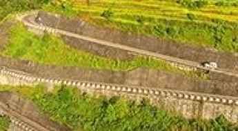
The New Road from Jomsom to Rara Lake: A High-Altitude Frontier in Nepal
A monumental road project is currently underway in the remote Himalayas of Nepal, aiming to connect the iconic district of Upper Mustang with the pristine Rara Lake in the far west. This route is set to become one of the most scenic and dangerous high-altitude drives in the world, traversing the isolated and mystical region of Dolpo.
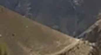
What are the highest roads in Nepal?
Nepal is home to some of the highest and most remote roads in the world, shaped by the country’s extreme Himalayan terrain and limited infrastructure. Located between India and China, Nepal rises sharply from lowland plains to eight of the world’s fourteen 8,000-meter peaks, creating an environment where transportation routes must navigate steep valleys, unstable slopes, and high-altitude passes. Many of these roads serve as essential links for trade, local travel, and access to isolated communities, despite their exposure to landslides, seasonal closures, and unpredictable weather.
How to get by car to the scenic Mo La Pass
Mo La is a high mountain pass at an elevation of 5,024 m (16,482 ft) above sea level, located in the remote Upper Dolpo region of Nepal. It's one of the highest roads in the country.
How to get to the summit of Niwar La Pass in the Dhawalagiri Zone
Niwar La is a high mountain pass at an elevation of 5,204 m (17,073 ft) above sea level, located in the remote Dhawalagiri Zone of Nepal. It's one of the highest roads in the country.
Ultimate 4wd destination: Driving the wild Mukot La in Upper Dolpo
Mukot La is a high mountain pass in Nepal’s remote Upper Dolpo region. A gravel road on the northern side climbs to an elevation of 5,606 m (18,392 ft), stopping just a short distance from the summit. It's one of the highest roads in the country.
How to get by car to Selma Lake in Karnali?
Selimā Daha is a high mountain lake at an elevation of 4,573m (15,003ft), located in the Karnali Zone of Nepal.
Sangdui La: Driving the high-altitude military frontier at 5,103m
Located just a few kilometers east of its twin pass, Siyaba La, the Sangdui La is an international mountain pass reaching a staggering elevation of 5,103m (16,742ft) above sea level. This high-altitude track sits directly on the border between the Mustang District of Nepal and the Tibet Autonomous Region of China, forming part of a sensitive military corridor in the Himalayas. It's one of the highest roads in the country.
How to drive the steep road to Sang Da La?
Sang Da La is an extreme high-mountain pass at an elevation of 5,310 meters (17,421 ft) above sea level, located in the Mustang District of Nepal. It’s one of the highest roads in Nepal.