What are the driving challenges of the 4x4 track to Khar Lake?
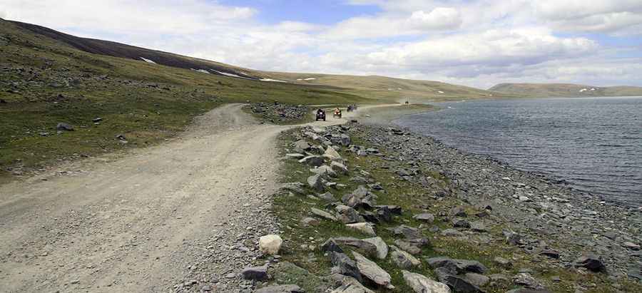
Khar Lake (Khar Nuur) is a freshwater basin situated at an elevation of 2,537m (8,323ft) above sea level, located in the Bayan-Ölgii Province of western Mongolia. The route to the lake is an unpaved track that crosses the valleys of the Altai Mountains.
| Road facts: Khar Lake (Khar Nuur) | |
|---|---|
| Location | Bayan-Ölgii Province, Mongolia |
| Elevation | 2,537 m (8,323 ft) |
| Length | 48.8 km (30 miles) from Khushoot |
| Surface | Unpaved / Braided Dirt, Sand & Gravel |
How long is the track to Khar Lake?
The unpaved mountain track is 48.8 km (30 miles) long, starting from the settlement of Khushoot. The alignment climbs through the Altai ridges before dropping into the lakeside depression at 2,537 meters. The route lacks signs, fences, or painted markers throughout the entire mountain segment.
What is the road surface to Khar Lake?
The road consists of multiple braided tracks of loose gravel, deep sand pockets, and hard-packed steppe soil. The surface features continuous corrugations, known as calamina, and deep holes caused by the wheels of heavy transport units. Vehicles require high undercarriage clearance and four-wheel drive to avoid grounding the chassis on the central ridges of the path.
How does weather affect driving to Khar Lake?
Summer storms quickly turn the clay and loam soil into mud, reducing tire adhesion and filling the track ruts with standing water. In low-lying zones near the lake basin, water accumulation hides submerged rocks and soft mud holes that trap heavy vehicles. Between October and April, sub-zero temperatures freeze the track layers, and snow accumulations close the high passes of the Bayan-Ölgii region.
Pic: Alexey Shpuk