Munkh Hayrhan: An Extreme 4x4 Drive in the Mongolian Altai
Mönkhkhairkhan (Munkh Hayrhan) is a massive mountain peak located on the boundary of Bayan-Ölgii and Khovd Provinces in western Mongolia. While the glacier-capped summit reaches 4,362m, a rugged high-mountain track near the peak tops out at an impressive 3,145m (10,318ft) above sea level. This is not a conventional road; it is a brutal test of endurance in one of the most remote corners of the Altai Mountains.
How long is the road to Mönkhkhairkhan?
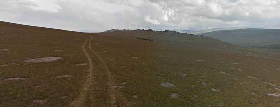
Starting from the village of Mönkhkhairkhan (a sum of Khovd Province), the road stretches for approximately 35 km (22 miles) into the wild. The track is extremely difficult to follow as it is not clearly marked and, in many sections, it is totally unpaved and covered with grass. It feels more like a primitive mule trail than a road, requiring constant vigilance and GPS navigation to avoid getting lost in the vast Mongolian steppe.
🇰🇿 Munkh Hayrhan Expedition Data
| Max Driving Height | 3,145m (10,318ft) |
| Total Distance | 35 km (22 miles) |
| Surface Type | Grass-covered mule trail |
| Starting Point | Mönkhkhairkhan Sum |
How challenging is the road to Mönkhkhairkhan?
The drive is a relentless sequence of obstacles running through rugged landscapes. The path is full of steep, sudden turns and countless bumps of varying sizes and impacts, often caused by the freezing and thawing of the permafrost. The "road" demands a high-clearance 4x4 vehicle and a driver capable of handling unpredictable terrain where tracks often disappear entirely.
How remote is the road to Mönkhkhairkhan?
Set high in the Altai mountain range, the drive provides dramatic views of the Mönkhkhairkhan National Park. Facilities like electricity, medical aid, hot running water, or western toilets are non-existent here. Travelers must be entirely self-sufficient. Reaching the end of the track offers a rare view of the sacred glaciers, a site of great spiritual importance for the local Uriankhai nomads.