Driving the high 4x4 track to Pereval Dzhargart
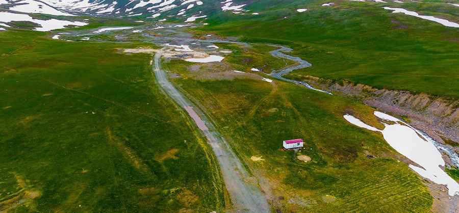
Pereval Dzhargart is a high-altitude mountain pass reaching an elevation of 3,540 meters (11,614 ft) above sea level, located on the boundary between the Talas and Chuy regions in Kyrgyzstan. This pass is a technical off-road challenge that branches off from the Pereval Ala-Bel, located on the legendary Pamir Highway (M41). Driving here means leaving the relative safety of the main transit route to face a raw, unpaved track where the high summit altitude and the rough gravel surface demand a high-clearance 4WD vehicle and a driver who knows how to manage a vehicle at the limits of its performance.
| Road facts: Pereval Dzhargart | |
|---|---|
| Location | Boundary of Talas and Chuy, Kyrgyzstan |
| Elevation | 3,540m (11,614ft) |
| Length | 4.37 km (2.71 miles) |
| Average Gradient | 8.35% |
How challenging is the road to Pereval Dzhargart?
The 4.37-kilometer ascent from the M41 junction is a concentrated grind. While the distance is short, the elevation gain of 365 meters results in a sustained average gradient of 8.35%. The surface is entirely unpaved and exceptionally rough, consisting of loose gravel and sharp stones that have been exposed by the harsh Kyrgyz winters. This is a technical 4WD-only trail where the road is narrow and features several tight hairpin turns. Navigating these switchbacks requires precision, as the lack of traction on the steep ramps makes it easy to spin out if you don't maintain a steady, low-gear crawl.
What are the main hazards on the Dzhargart mountain track?
The primary hazard at Pereval Dzhargart is the extreme altitude combined with the volatile high-mountain weather. At 3,540 meters, your engine will lose approximately 35% of its power due to the thin air, making even an 8.35% gradient feel much steeper. The track is highly subject to winter snowfalls and can be blocked by snowdrifts at any time, even outside the peak winter months. There are no safety barriers, and the "dangerous drops" on the narrow segments provide zero margin for error. If you encounter a rockslide or a washed-out section, the logistics of reversing on such a steep, narrow trail are complex and high-risk.
Is the road to Pereval Dzhargart open year-round?
No. Due to its position above 3,500 meters, the pass is often impassable for a large part of the year. Snowmelt usually allows access by late June, but early autumn storms can close it again by September. The trail is not part of any regular maintenance circuit, so the access is only cleared if local logistics demand it. If you attempt the crossing without verifying the local conditions at the Pereval Ala-Bel, you risk getting stuck in a high-isolation sector where passing traffic is non-existent and the cold can be lethal even in mid-summer.
What mechanical prep is needed for the 3,540m Kyrgyz climb?
Before leaving the Pamir Highway, verify that your cooling system and air filters are 100% reliable. The climb to Pereval Dzhargart is a torture test for a radiator, as the thin air is less efficient at cooling a motor that is working under high load at slow speeds. Check your tire sidewalls for cuts; the rough gravel of the Talas-Chuy boundary is expert at destroying standard rubber. On the descent, do not ride your brakes to manage the 8.35% gradient; use engine braking in low range to maintain control. Carry at least 20 liters of extra water and a full-sized spare, as a breakdown at this altitude is a survival situation in one of the most rugged mountain regions of Central Asia.
Pic: Roman Pachaev