Pereval Kyzyl-Kasa: Driving the 3,546m Dead-End Track in Nookat
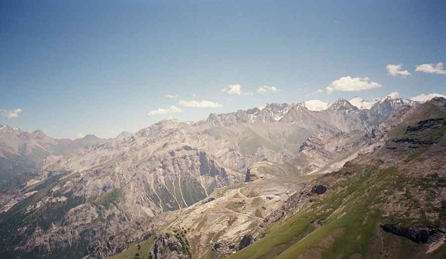
Located in the Nookat District of the Osh Region in southwestern Kyrgyzstan, Pereval Kyzyl-Kasa (Перевал Кызыл-Каса) is a high-altitude mountain pass reaching 3,443m (11,295ft). The track is one of the more technical routes in the Alay Mountains, serving as a remote access path that actually continues beyond the pass to a summit at 3,546m.
| Road facts: Pereval Kyzyl-Kasa | |
|---|---|
| Location | Nookat District, Osh Region, Kyrgyzstan |
| Pass Elevation | 3,443 m (11,295 ft) |
| Road End Elevation | 3,546 m (11,633 ft) |
| Length | 16.6 km (10.3 miles) |
| Elevation Gain | 1,296 meters |
| Avg Gradient | 7.80% |
How is the drive to Pereval Kyzyl-Kasa?
The ascent begins in the village of Kalday and covers 16.6 km (10.3 miles) of entirely unpaved terrain. This is a sustained high-altitude climb with a massive 1,296-meter elevation gain. While the average gradient sits at 7.80%, the reality on the ground is much more punishing. The track is carved into steep, loose slopes where the surface is a mix of packed earth and jagged rock. A high-clearance 4x4 with low-range gearing is mandatory, as the final sections toward the 3,546m peak feature steep inclines that require constant torque and traction.
Is the road to the pass open in winter?
No. At nearly 3,500 meters, this road is impassable for most of the year. Winter snow makes the track disappear completely, and the area is a high-risk zone for avalanches. Even in late spring, melting snow turns the dirt path into a deep mud trap. The window for driving to the summit is short, typically from July to early September. Even during these months, sudden mountain storms can drop the temperature below freezing and leave the track dangerously slick.
What are the main hazards in the Nookat mountains?
The primary hazards are the narrow shelf road sections and the lack of safety barriers. The track often clings to the mountainside with sheer drops off the edge. Because it is a dead-end road that ends at a peak south of the pass, there is almost no maintenance; you will encounter rocks on the track, deep ruts, and sections where the shoulder has eroded. At 3,500 meters, engine power is significantly reduced, so you must monitor your radiator closely during the 1,296m climb to prevent overheating in the thin air.
Logistics and Self-Sufficiency
This is a total wilderness drive. There are no services, fuel, or mobile signal once you leave the Kalday area. You must carry at least one full-size spare tire and basic recovery tools (shovel, tow straps). The road ends at a high point with limited space to turn around; ensure you scout the end of the track before committing a large vehicle. Due to the isolation of the Osh Region mountains, it is highly recommended to travel with at least one other vehicle in case of mechanical failure.
Road suggested by: Hugh Wilson
Pic: Igor Goncharov