How to get to Engilchek Mine in the Issyk-Kul Region?
Located in the Issyk-Kul Region of Kyrgyzstan, Engilchek Mine was a tungsten, tin, molybdenum, and other metals mine, topping out at 3,791 m (12,437 ft) above sea level. It’s one of the highest roads in the country.
Where is Engilchek Mine?
The mine is located in the Sary-Jaz Valley, at the confluence of the rivers Saryjaz and Engilchek, in Ak-Suu District, in the southeastern part of the Issyk-Kul Region, in the eastern part of the country.
Is Engilchek a ghost town?
The mine was named after the nearby Engilchek Village (also spelled Inylchek or Enilchek). Once a Soviet mining settlement (for tungsten and tin), it’s now largely deserted. The village has a haunting, almost “ghost town” atmosphere, with abandoned buildings and remnants of Soviet-era infrastructure. A small number of locals and seasonal workers still live or work in the area, especially during the summer trekking season.
Can I drive to Engilchek?
Mining started here at the beginning of 1980. With the closure of the mine, it’s now one of the most isolated areas on our planet, a depressed and almost deserted tin-mining town. The area is extremely sparsely populated, with Engilchek Village itself nearly abandoned after the collapse of the Soviet Union. Due to its location close to the border with China, it is a restricted military zone, and one needs permission to visit the area.
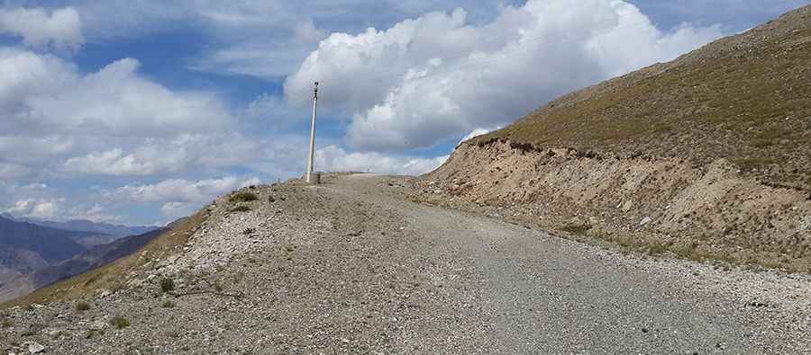
Is the road to Engilchek Mine challenging?
The road to the mine is totally unpaved and steep. It is very narrow with dangerous drops. A 4x4 vehicle is required. The road is collapsing slowly. There is an extreme risk of rock slides.
How long is the road to Engilchek Mine?
Starting from Engilchek, the ascent is 19.1 km (11.86 miles) long with 27 sharp hairpin turns. The elevation gain is 1,273 meters. The average gradient is 6.66%.
Is the road to Engilchek Mine open year-round?
Set high in the Central Tian Shan, winters are long and severe; access is difficult or impossible for much of the year.
Pic: SnakeSolid Krg