How to drive the road to Pereval Chunkur?
Pereval Chunkur is an international high mountain pass reaching an elevation of 3,111m (10,206ft) above sea level, situated on the border between the Jambyl Region of Kazakhstan and the Talas Region of Kyrgyzstan. The route is a significant logistical link across the Tian Shan range, spanning 26.7 km from the settlement of Uych-Emchek. The road is characterized by its mixed surface—combining paved and unpaved sectors—and a sustained vertical climb that requires disciplined engine management and specialized vehicle preparation.
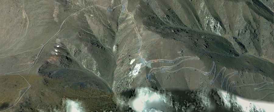
| Road facts: Pereval Chunkur | |
|---|---|
| Location | Kazakhstan-Kyrgyzstan Border |
| Elevation | 3,111 m (10,206 ft) |
| Length | 26.7 km (16.5 miles) |
| Elevation Gain | 1,560 m |
| Average Gradient | 5.84% |
What are the surface logistics and traction challenges on Pereval Chunkur?
The 26.7 km road to Pereval Chunkur presents a technical challenge due to its mixed surface. While some sectors are paved, the transition to unpaved gravel often occurs on the steeper gradients. Logistically, this requires tires capable of maintaining a high friction coefficient on loose soil while sustaining high-speed stability on asphalt. With an average gradient of 5.84%, maintaining momentum is essential; any loss of traction on the unpaved switchbacks can lead to surface degradation. A 4WD vehicle with an All-Terrain (A/T) tire setup is the technical recommendation to manage the 1,560-meter vertical ascent safely.
How does the 1,560m elevation gain impact engine performance on Pereval Chunkur?
Starting from Uych-Emchek, the ascent to Pereval Chunkur involves a massive 1,560-meter elevation gain. This sustained climb puts extreme thermal stress on the engine's cooling system. At the 3,111-meter summit, air density is lower, resulting in reduced oxygen intake and decreased torque. Logistically, drivers must utilize the transmission to stay within the power band, avoiding lugging the engine in high gears. It is a mandatory protocol to check the radiator and coolant levels before starting the 26.7 km transit, as the combination of steep gradients and high altitude can lead to rapid overheating, especially under heavy load or during slow-speed maneuvers.
What are the winter hazards and closure protocols for Pereval Chunkur?
Due to its elevation in the Central Asian highlands, Pereval Chunkur is typically impassable during the winter months. Heavy snowfall and drifting make the 26.7 km route logistically unmanageable from late autumn to early spring. Even during the transition seasons, the road is prone to "black ice" on the paved sections and deep mud on the unpaved parts. Technical preparation for this pass must include carrying recovery gear and ensuring the vehicle is equipped with high-intensity lighting for the frequent fog conditions. There is no logistical support or mechanical assistance along the border crest, making self-sufficiency vital for all transits.
What is the cross-border logistical status of Pereval Chunkur?
As an international pass linking Kazakhstan and Kyrgyzstan, Pereval Chunkur is subject to border control protocols that can affect transit times. Logistically, the road serves as a secondary route between the Jambyl and Talas regions. Drivers must verify the operational status of the border post before committing to the 26.7 km climb, as seasonal or geopolitical closures can force a total turnaround. Because the road is narrow and lacks modern safety barriers in the unpaved sectors, any transit during night hours is technically discouraged. It is also a logistical necessity to carry extra fuel, as the sustained 5.84% gradient significantly increases consumption compared to the low-altitude plains.
Road suggested by: Hugh Wilson.