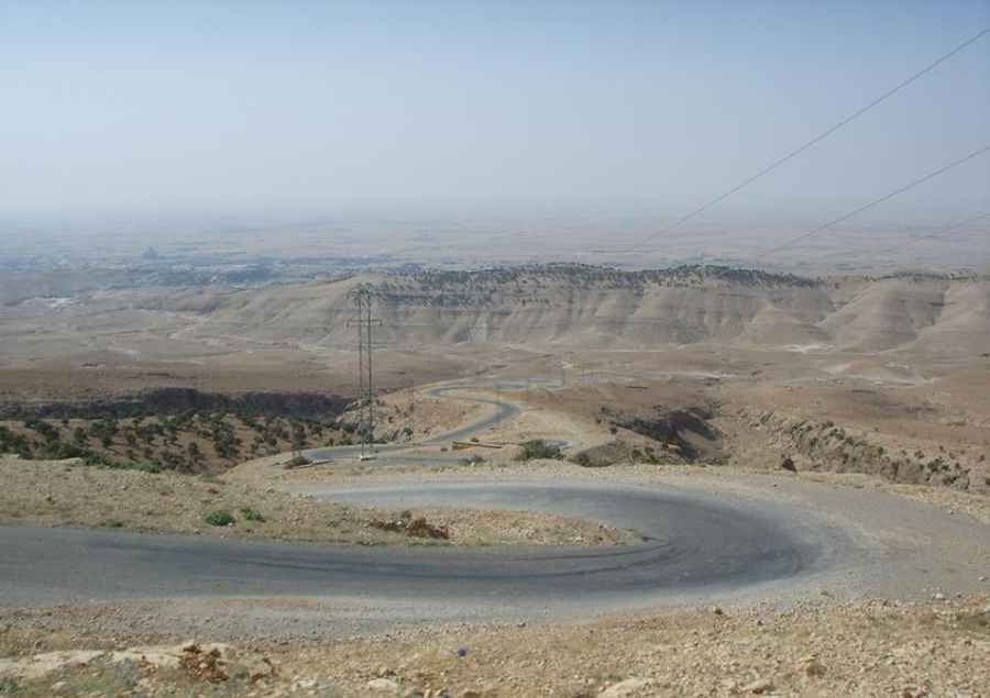
More than 100 hairpin turns on the road to Mount Sinjar
Mount Sinjar is a mountain peak at an elevation of 1.319m (4,327ft) above sea level, located in the Nineveh Governorate of Iraq.
Is the road to Mount Sinjar paved?
Tucked away in the northwestern part of the country, the road to the summit is entirely paved. It’s called Sinjar Mountain Road. It’s an extremely defiant drive, with around 100 hairpin turns, and narrow and steep parts. Depending on the time of year, travelers might face extreme weather conditions, such as intense heat in summer or cold in winter. Remember drivers do not respect traffic laws and speeding and tailgating are common practices.
How long is the road to Mount Sinjar?
The road to the summit is 13.5 km (8.38 miles) long starting from Sinjar, a city with the same name. Over this distance, the elevation gain is 805 m and the average gradient is 5.96%.
Is it safe to drive to Mount Sinjar?
Avoid all travel to Iraq due to a continued volatile, unpredictable, and potentially dangerous security situation. The region has seen significant conflicts, including the presence of ISIS and other terrorist groups. Foreign governments advise against non-essential travel to parts of Iraq, including the area around the peak. The area also faces risks from landmines and unexploded weapons. Kidnappings and terrorist attacks, especially with foreigners, remain a concern. Travel by road remains highly dangerous. Fatal roadside bombings and attacks on military and civilian vehicles continue to happen. There is also a risk of carjacking and robbery.
Pic: Jose Munoz