How to drive to Gardaneh Sar: Is the road too steep for your car?
Gardaneh Sar is a mountain settlement at an elevation of 2,935m (9,629ft) above sea level, located in the Mazandaran Province of northern Iran. The route to this village climbs the Alborz mountain range, running on the southern slopes of Mount Damāvand.
| Road facts: Gardaneh Sar | |
|---|---|
| Location | Mazandaran Province, Iran |
| Elevation | 2,935 m (9,629 ft) |
| Length | 7.5 km (4.66 miles) |
| Average Gradient | 10.18% |
| Surface | Unpaved / Loose Dirt & Stones |
How long is the road to Gardaneh Sar?
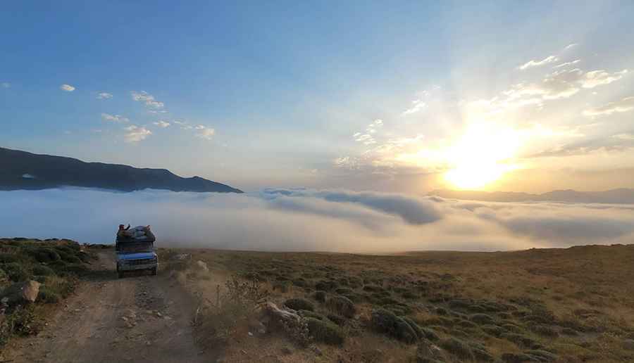
Starting from Mian Deh, the track to Gardaneh Sar is 7.5 km (4.66 miles) long. The elevation gain is 764 meters, with a continuous average gradient of 10.18%. The lane winds up the mountain slopes, forcing vehicles into first and second gear to manage the constant incline. It is listed among the highest roads of Iran.
Is the road to Gardaneh Sar unpaved?
The surface is entirely unpaved, consisting of loose gravel, compacted soil, and rocks. Due to the grade and the shifting stones, a 4x4 system with high ground clearance is required to maintain traction. The track is single-lane wide without shoulders or side protections. Rain turns the dirt sections into mud layers, while winter snow blocks the route completely from November until May.
What are the hazards on the road to Gardaneh Sar?
The track has no lateral steel barriers or safety infrastructure. The open mountainside is exposed to rockfalls from the cliffs and crosswinds on the ridge sections. There are no fuel stations, mechanical workshops, or water points between Mian Deh and the settlement. Vehicles must be driven on low gear ratios to control speed on the descent and prevent tire slippage on the loose gravel.
Pic: Iman Ansari