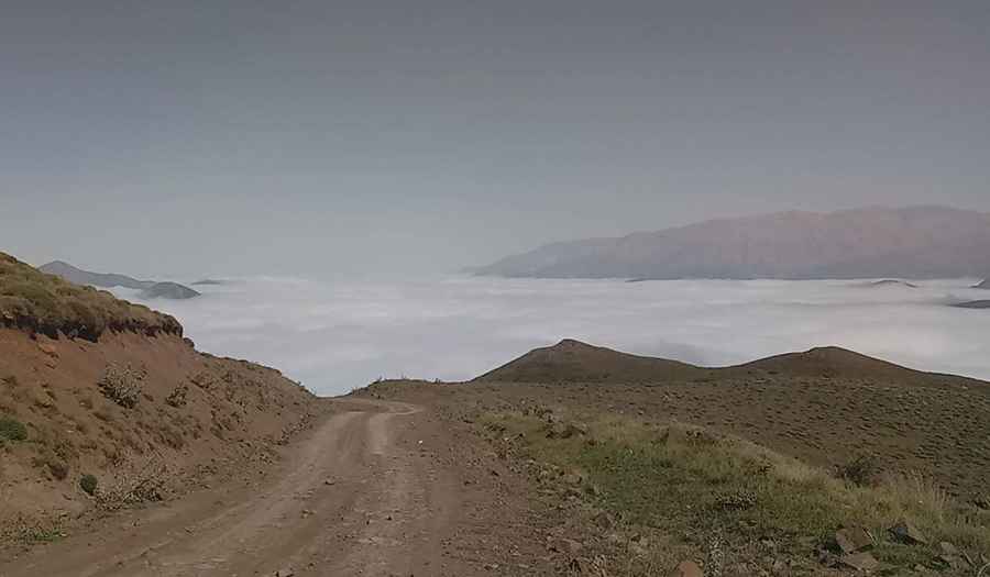
A beautiful mountain road to Anbarkesh Pass
Anbarkesh Pass is a high mountain pass at an elevation of 2,776m (9,107ft) above sea level, located on the boundary between Mazandaran and Qazvin provinces in northern Iran.
Where is Anbarkesh Pass?
The pass is located south of NaftChak Peak, in the northern part of the country. It connects the village of Separ Deh (Eshkevar Rural District, Mazandaran) with Viar (Rudbar-e Shahrestan Rural District, Qazvin).
| ROAD FACTS: ANBARKESH PASS | |
|---|---|
| Elevation | 2,776 m (9,107 ft) |
| Surface | Totally Unpaved |
| Length | 23 km (14 miles) |
| Location | Mazandaran / Qazvin Border |
How long is the road to Anbarkesh Pass?
The road through the pass is 23 km (14 miles) long. It serves as a high-altitude link between the Central District of Ramsar and the Alamut-e Gharbi District.
Is Anbarkesh Pass unpaved?
Yes, the road to the pass is totally unpaved. The track includes numerous curves and hairpin turns. Due to the presence of steep drops and the nature of the terrain, it is a technical drive that requires experience in mountain environments.
What vehicle is required for Anbarkesh Pass?
A 4x4 vehicle is required to navigate the loose surface and the gradients of the route. Standard passenger vehicles are not suitable for this terrain.
When is the best time to drive to Anbarkesh Pass?
The best time to drive this road is during late spring and early summer, specifically in June and July. During the rest of the year, snow and adverse weather conditions in the Alborz Mountains typically make the pass inaccessible.
Pic: Mehran Shesh Baradaran