Leh-Manali Highway is an epic journey across the Roof of the World
Embark on a journey through the Himalayas with the Leh-Manali Highway. This mountain road, known for its challenges, takes us through some of the world's highest passes. From its strategic importance to the day-to-day life around it, we'll explore the key aspects of this iconic route. Join us in unraveling the story of the Leh-Manali Highway—a testament to both engineering and the raw beauty of the landscapes it traverses.
How long is Leh-Manali Highway?
The road is 479 km (298 mi) long, running from Leh (in Ladakh in Jammu and Kashmir state) to Manali (in Himachal Pradesh state). It crosses some of the world’s highest passes, averaging well over 17,000 feet.
Why is the Leh-Manali Highway famous?
Because of the important position of Ladakh between China and Pakistan, this highway plays a crucial strategic role for India, resulting in the maintenance of the road by the Indian army itself. In addition to the spectacular landscape, life on and next to the road is diversified due to a wide variety of people frequenting it. Construction workers from other parts of India work for better road conditions during the summer. The road, built and maintained by the Indian Army, plays a crucial role in the movement of armed forces in Ladakh. It's cleared by the Border Roads Organisation (BRO).
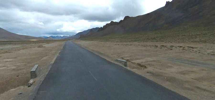
Is the Leh-Manali Highway paved?
The road has been improved in recent years. Currently, it’s mostly paved. It’s incredible what kind of vehicles are using the road - from tankers and goods lorries, army trucks to whatever else comes along with a motor in it, or without the motor, as some cyclists do. There are several bad patches; water crossings you will need to cross; and several badly broken dirt trails; but overall, the condition of the road is not as bad as everyone perceives it to be. Extremely bad sections of the road will mostly be around Rohtang Top and near Tanglang La. For the rest of the journey, it will be a mix of smooth, good, okay, and bad.
Is Leh-Manali Highway open?
It’s accessible for cars and trucks during several months in summer only and tops out at 5,328m (17,480ft) above sea level, at Taglang La mountain pass. At this elevation it's one of the highest roads of the country. This road is usually open for only about four and a half months a year, in summer between May or June when the snow is cleared by the Border Roads Organisation of the Indian army, and mid-October when snowfall again blocks it. Owing to the rarefied atmosphere (low air pressure) at high altitude, less oxygen is breathed in, and many travelers experience altitude sickness or acute mountain sickness, causing headaches, nausea, dizziness, and vomiting. Ladakh is a cold semi-arid desert. It is cold along the highway even in summer (June onwards); the days are warm in bright sunshine but the nights are very cold.
How long does it take to drive the Leh-Manali Highway?
Part of National Highway 3, it takes about one full day by jeep or two days by bus. Tourists from all over the world, as well as a growing number of Indian tourists, use this road for the scenic impressions of the mountains. Truck drivers transport their cargo to Leh and back to other parts of India.
Is the Leh-Manali Highway dangerous?
The trip on this road includes a lot of dangers. The road itself, with trucks and buses that sometimes travel only at 15 to 20 km/h due to the road condition. This is not the most comfortable drive in the world. This is not helped by the fact that some of the roads have drops to the side of a good few hundred meters. You can observe crashed and unlucky vehicles covered with rust down the slope somewhere... And some of the passes are really spectacular, especially if you have to wait on the side of the road for a truck to pass... The road is one of the most complicated and challenging roads in the world, with snow, never-ending traffic jams, landslides, and terrain making the journey exceedingly difficult. Uncertain weather, high altitude, extreme cold, and no civilization for miles make this a very treacherous track. Carry extra fuel and feel close to heaven. It is also advisable to carry chocolates, glucose, or other high-energy food on the journey and spend only a little time at the high mountain passes. Mechanics and spare part shops are few and far between; Keylong is the best bet in case of any running repairs. Make it a point that you carry enough cash in your pocket as an ATM is available only in Manali and Keylong.
The road climbs up five major passes:
Rohtang Pass 3.979 m (13,054 ft)
Nakee La 4.769m (15,647ft)
Bara-lacha La 4.890m (16,043ft)
Lachulung La 5.059m (16,598ft)
Taglang La 5.328m (17,480ft)
Pic: M Yasi